Content
Preparation
I had just been to Mt Sinai and found to my disapointment that I did not have the time to climb both mountains in one go as I was part of an arranged trip from Sharm El Sheik. Back in Sharm El Sheik I tried to locate if there was to be arranged another trip to the St. Catherine Monastery area that I could join in order to climb Mt Catherine. No such luck in this time of season. I approached the conciergie at the hotel we were staying and asked what would it cost to rent a taxi from Sharm El Sheik to St. Catherine Monastery and have the taxi wait for me to climb the mountain and then take me back to Sharm El Sheik. This turned out to be 1.000 Egyptian Pounds and was well witin the limit I was prepared to pay. The only drawback was the fact that the conciergie told me that the mountain was closed on friday which now was my only option left to do the climb. I told him that I would not be visiting the monastery but only going into the mountains, but he maintaned the mantra that the mountain was closed.
Since there was a Tourist Police present at the trailhead I figured that because of the muslim holiday (which is on fridays) people were not allowed to go into the mountains at the Mt Sinai area. But the more I thought about it the more unsure I became of the validity of this information. Adding to this several experiences when talking to the egyptians that their command of the english language is not perfect and they tend to misunderstand what I said to them I decided to try another approach.
I called the travel agency that had arranged the trip because it is staffed by scandinavians and asked if they could find out if the mountains really were closed for people on fridays. They called me back after a short time and assured me that they had talked to local people and there ought to be no problem going into the mountains on a friday.
I went back to the conciergie with my new facts and he promised to check again. 10 minutes later he came to me and told me that it was ok to climb the mountain during a friday. Then the reservation of a taxi was the next issue. I wanted to travel from Sharm El Sheik at 02:00 so that we arrived at the trailhead at about 05:00. I did not want to start into the mountains when it was dark. Now both the conciergie and the taxi agency tried to convince me that I should start at 23:00 the evening before. As I had been to Mt. Sinai some days before, climbing at night in order to view the sunrise from the top, I understood that they thought that this was what I was going to do again even if I had explained at length to the conciergie that this time I was to start when the light permitted and was not going to Mt. Sinai but Mt. Catherine. Explaing this a couple of times more they finally came around and I was allowed to get a taxi at 02:00 on friday.
I went to bed early thursday evening in order to sneak some hours of sleep before departure, but found it difficult to sleep because of the excitement. This time I did not have a map of the area but only the rough outline of the terrain as seen from Mt Sinai a couple of days before. There I had clearly seen the Mt Catherine mountain and I had also seen the start of the trail from the foot of the mountain. I also had a rough idea of how to reach this trail. Also this time I would be travelling alone. My daughter, Sigrid, would rather spend her day by the pool than accompany her father to another mountain.
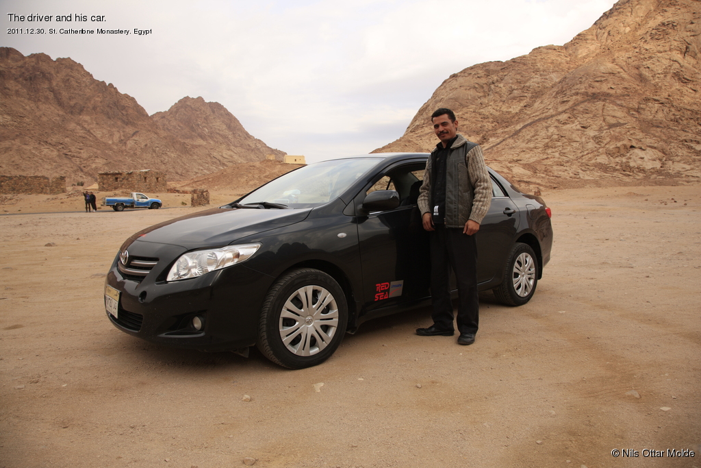
I had paid half of the fee up front and the rest would be paid on my safe arrival back to the hotel. Also since the taxi was ordered through the conciergie at the hotel I felt that this would not be a scam.
At 01:50 I was sitting outside the reception of the hotel and the taxi arrived 5 minutes later, and we were off. It was far more comfortable sitting in a taxi than in the bus we had used the previous trip. I still had problems sleeping due to some excitement and the fact that the Egyptians are very fond of putting up reflective sign showing the curves in the roads, causing much light to be reflected back into car.
Again we stopped at several checkpoints along the road where armed personell would check out the car. On two occasions I had to show my passport.
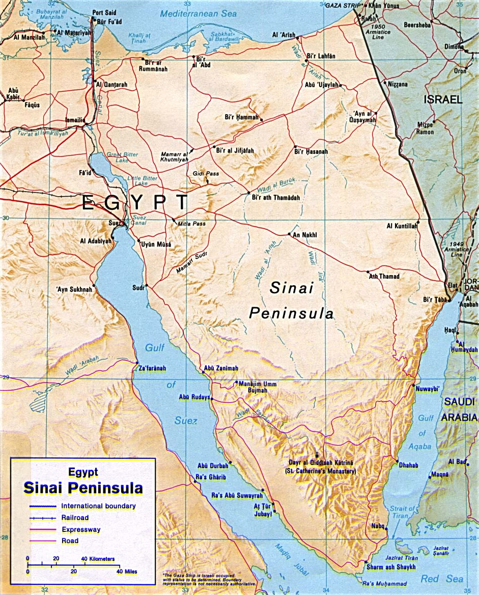
We arrived at the trailhead at about 05:00 but it was still pitch black. I could not see any buses at the parking lot so I figured that there would not be many people in the mountains today. I told the driver that I would wait a little bit longer before I started, so we both fell asleep in the car. At 05:50 I woke and now I could discern a faint grey light over the nearest mountains. Today it was cloudy so there were no stars. So I put on my gear and started out for the trailhead. I told the driver that I had no idea of how long it would take but estimated about 7 hours. I figured 4 to reach the top and 3 to return.
When I passed the Tourist Police office I was hugely relieved to see that this was not manned at this time of night. 5 minutes later I was engulfed in the dark on the trail and for the first time I felt nearly confident that this trip would be completed with success. Last time the temperature had been 2 �C (35.6 �F), but today it was much warmer. I estimated ca 10 �C (50 �F)
On the mountain
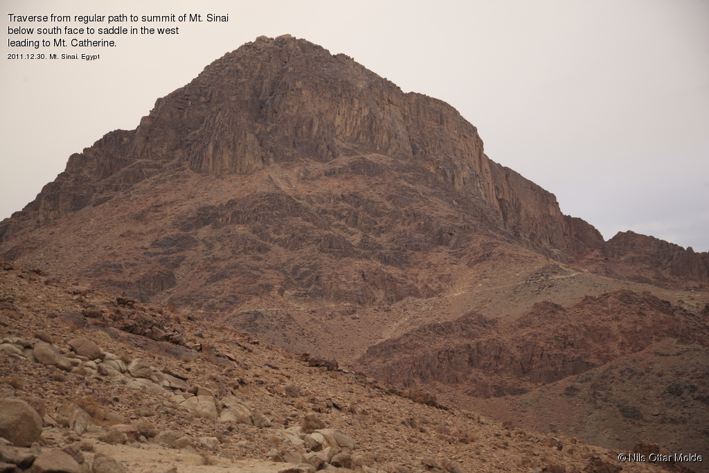
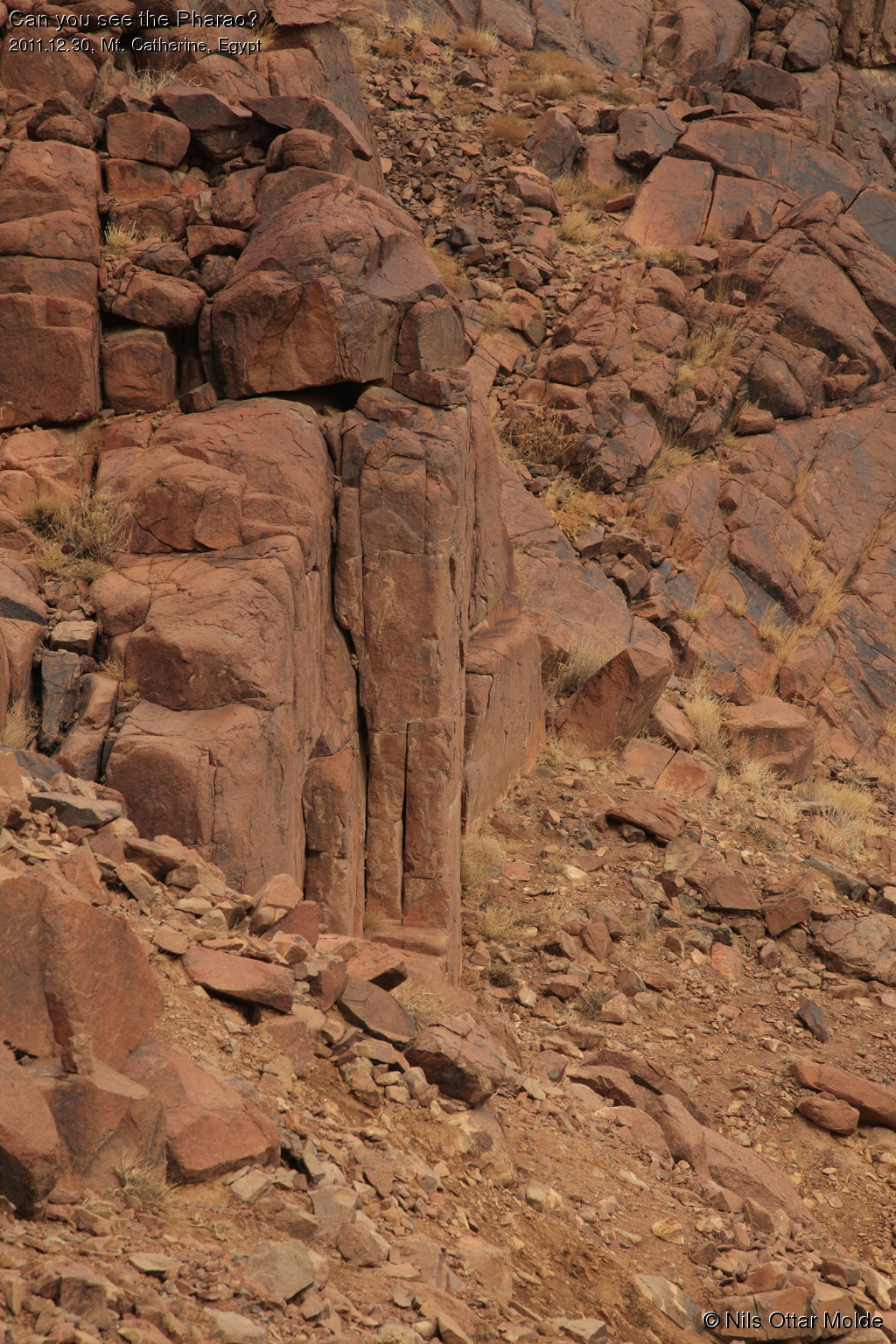
The first part of the trip would be on the path that led to Mt. Sinai but then I would diverge, going round the base of Mt Sinai in order to reach the saddle between the mountains and then head for the foot of Mt St Catherine finding the trail I had seen previously when standing on the top of Mt. Sinai. As the light grew stronger I made good progress and I now fully understood what the term "mountain is closed" meant. There where no natives trying to rent out their camels or manning the stalls selling water, soft drinks or chocolate. This was just how I liked it ... just me and the mountain.
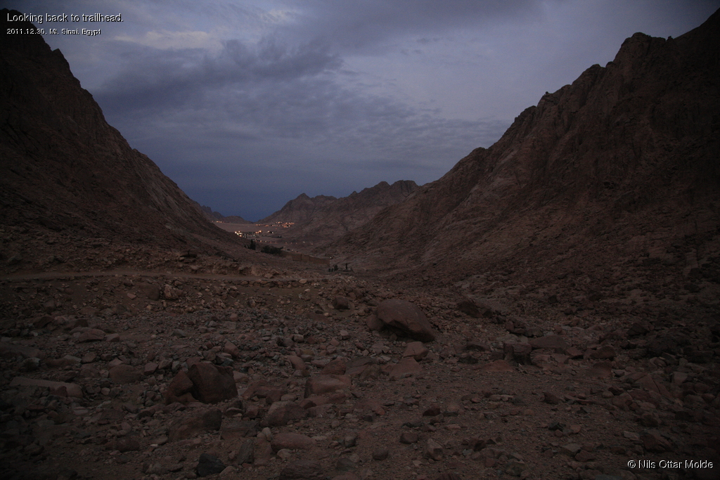
I soon came to the place where the trail made a fork, one going up to Mt Sinai and the other going along the base of the mountain. I choose the one I had figured would be the best, namely round the base of the mountain. This should turn out to be the wrong choice and would probably cost me 30 - 40 minutes in lost time. But at that time I had no better alternative and charged on.
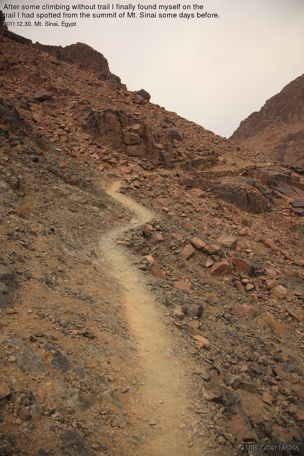
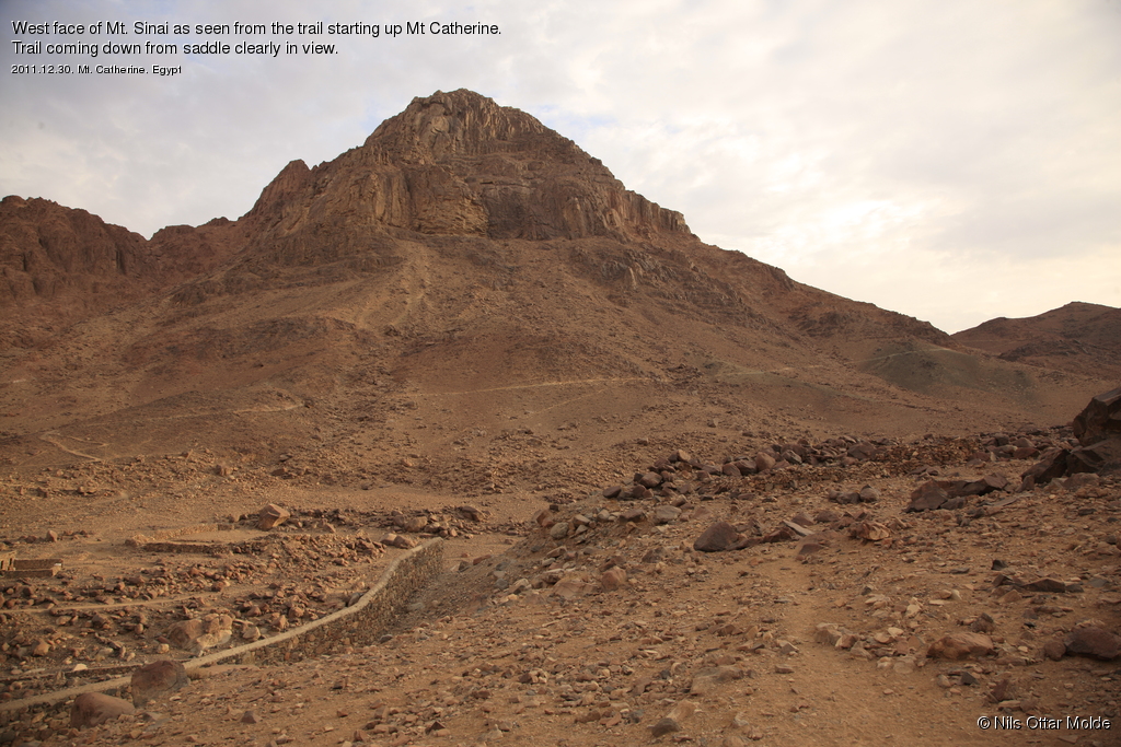
As I was going along the trail I was loosing altitude all the time and the trail got weaker and weaker as I tried to hold to higher ground every time the trail forked. Soon I came to the part where I had to start ascending in order to reach the trail I had seen from the top of Mt. Sinai that would take me to the saddle between the mountains. Now the trail I had started out on was none existent but I had good visual contact with where I wanted to end up so I had no problem making headway. And then I saw what turned out to be the (much) easier way to the saddle. If I had gone along the trail leading to the Mt. Sinai summit, in the final bend before the traverse below the rockface of the east wall of Mt. Sinai, there was a path leading directly to the saddle. I had not noticed this when I came down from Mt Sinai earlier in the week.
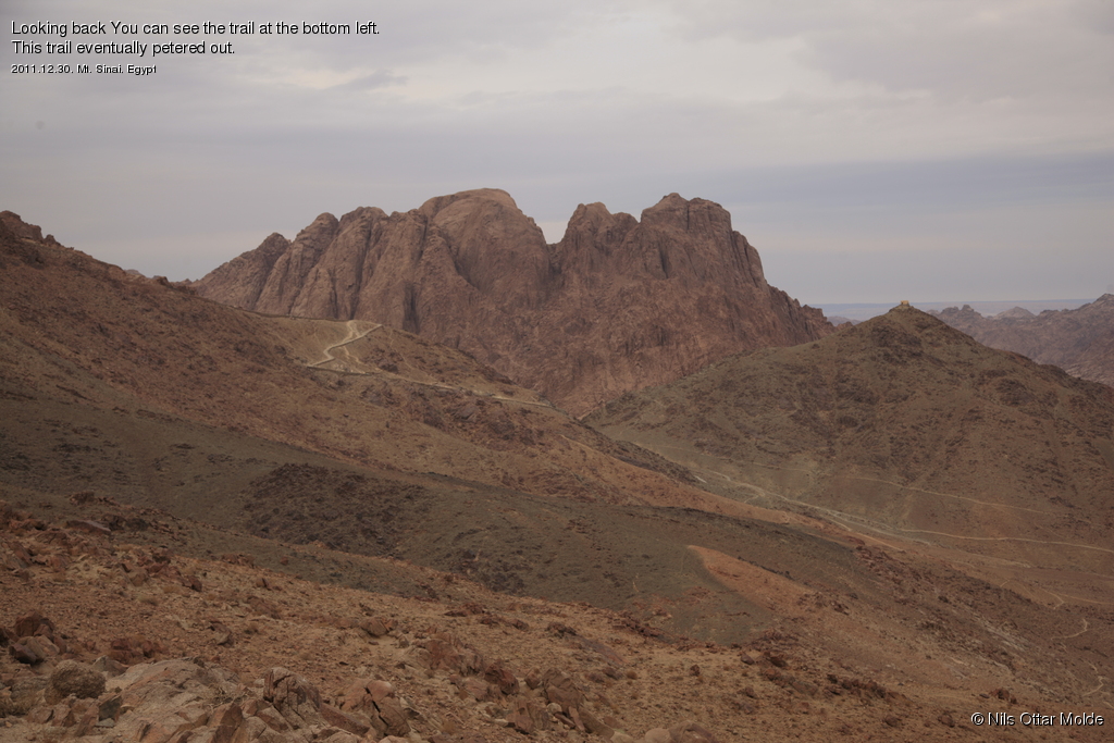
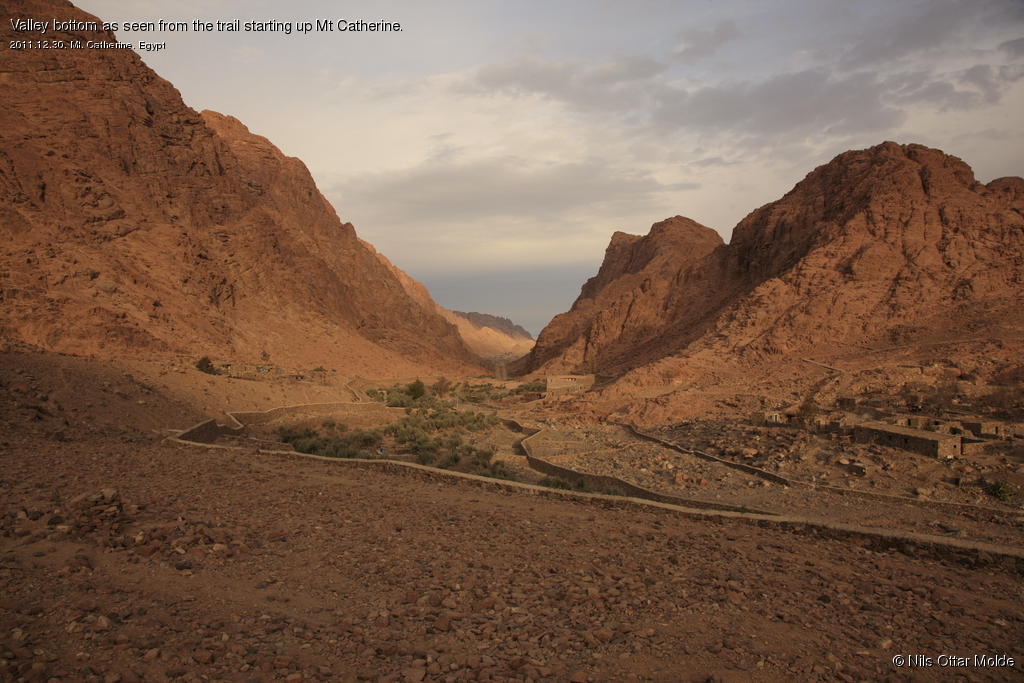
When I reached the saddle the wind was pretty strong, but it was still an OK temperature. I now looked down into a valley where the trail from the base of Mt. Catherine started. At least a descent of 200 metres. This also I had not noticed from the top. But there was nothing left to do than start the descent. It was still so early that I had no worries about the time.
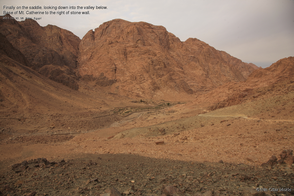
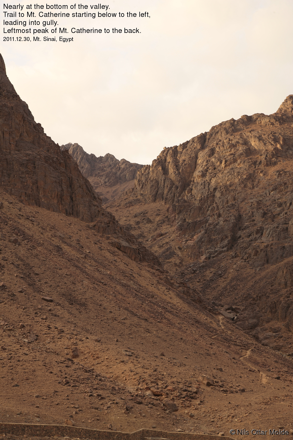
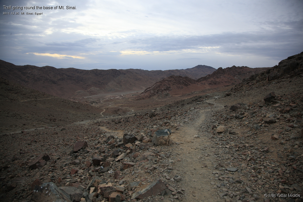
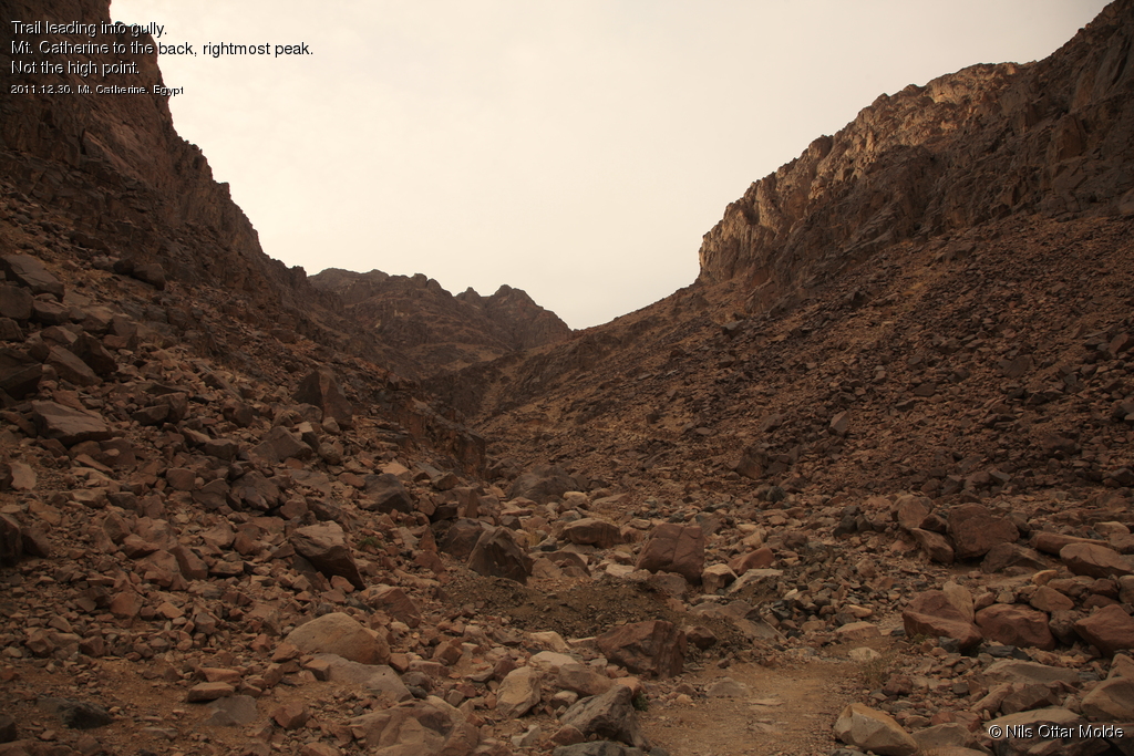
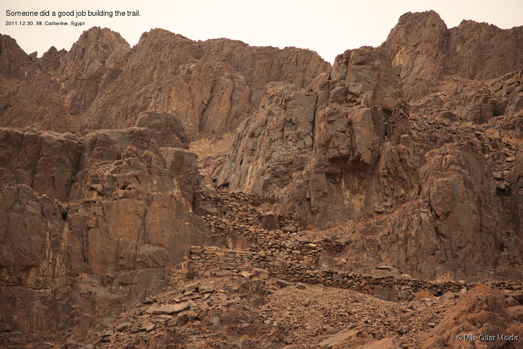
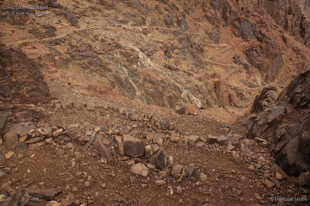
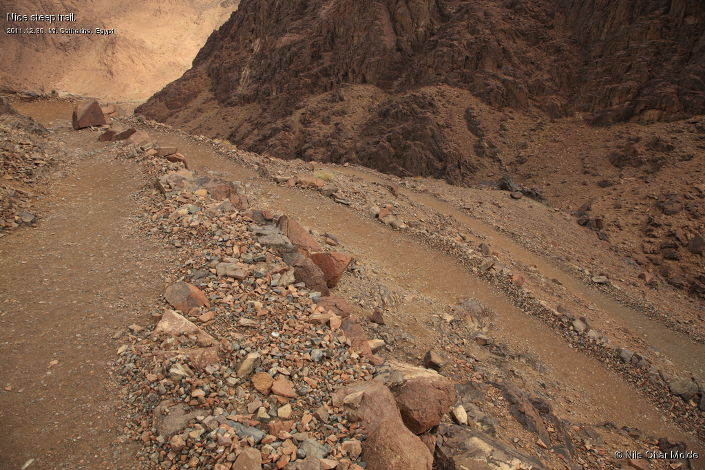
After an easy descent I crossed over the valley bottom and found the trail to Mt. Catherine leading into a huge gorge. The trail would be well defined all the way to the top with many switchbacks in steep terrain.
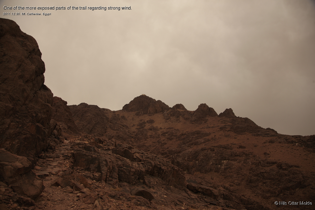
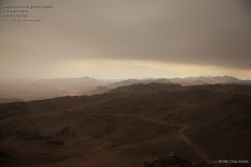
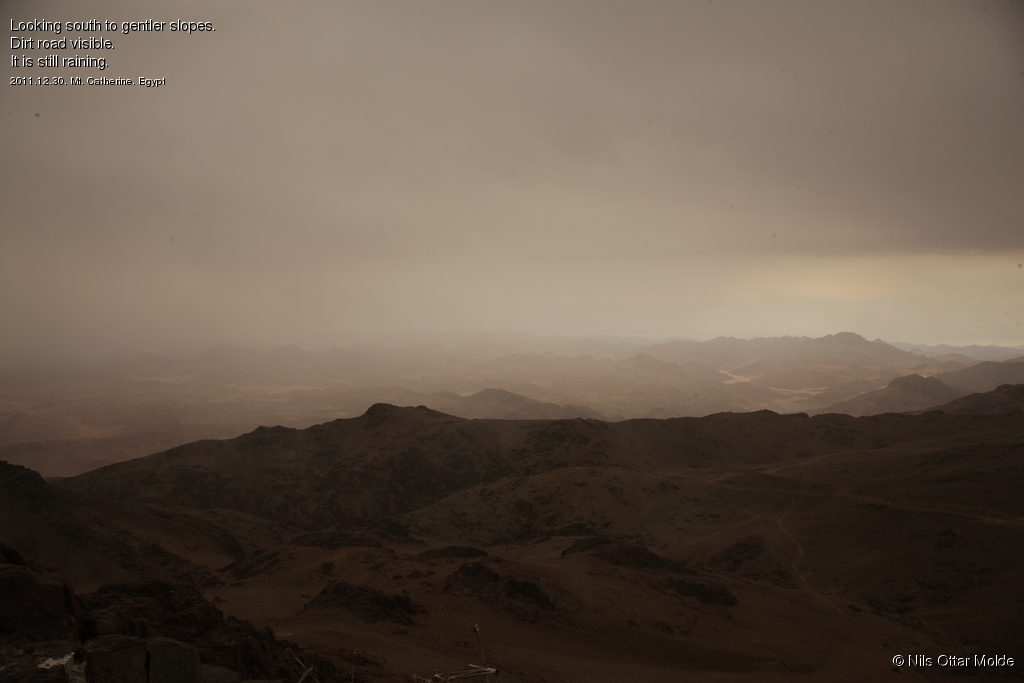
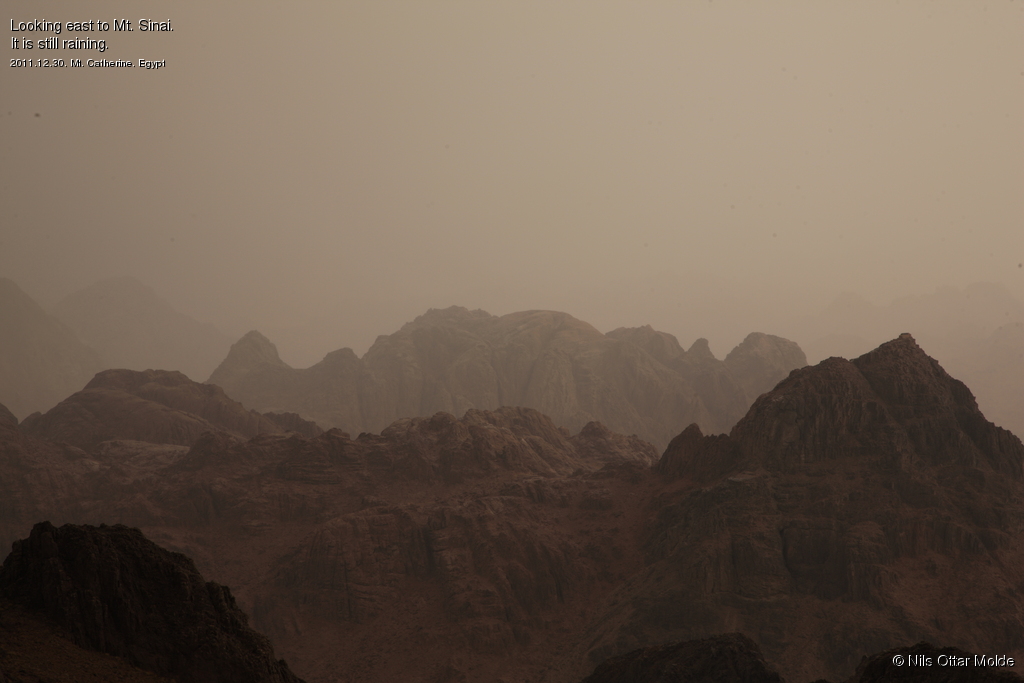
Now it was just to keep on the trail in order to reach my goal. To my big surprise it started raining. Also the wind got stronger and stronger as I ascended. When I went over a ridge in order to reach the last scree to the top, the wind had become so strong that it was hard breathing and I had to concentrate to stay on the trail. This was one of the more exposed part and for the most it was not uncomfortable except for my hands. I had of course left without gloves when I started and now I was paying the price. Wind and rain and not very warm quickly rendered my fingers numb. This would be the case from about 300 meters from the summit and until I was well below this height during the descent.
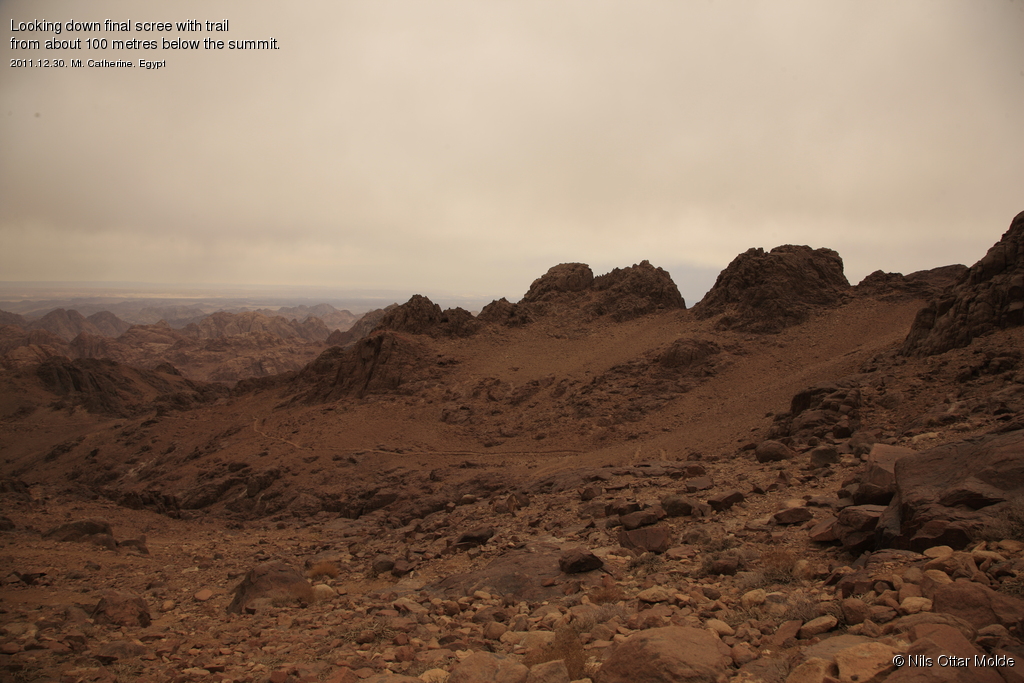
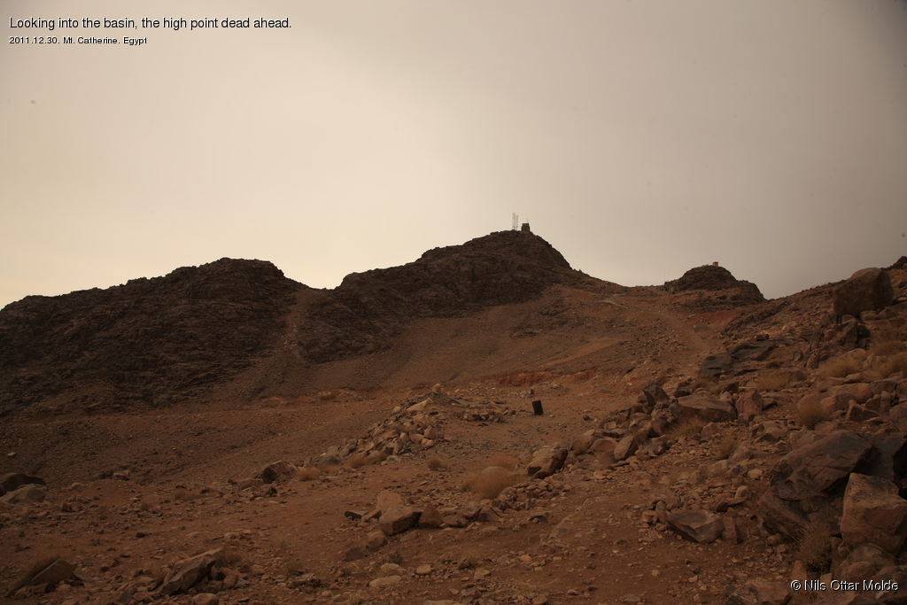
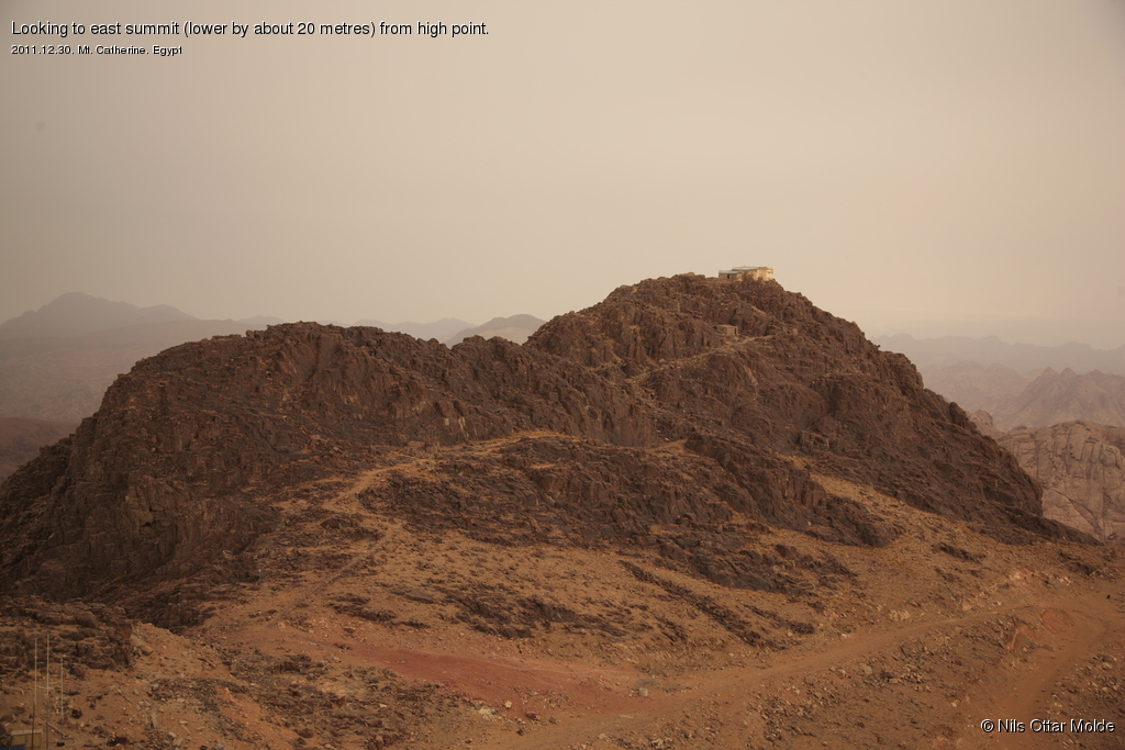
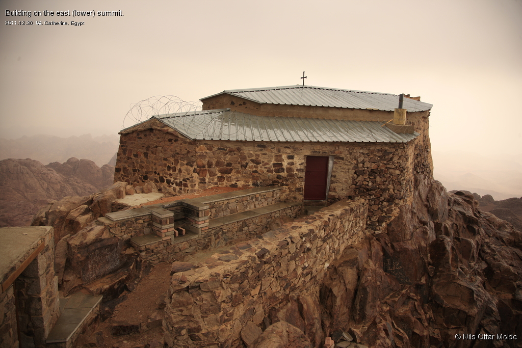
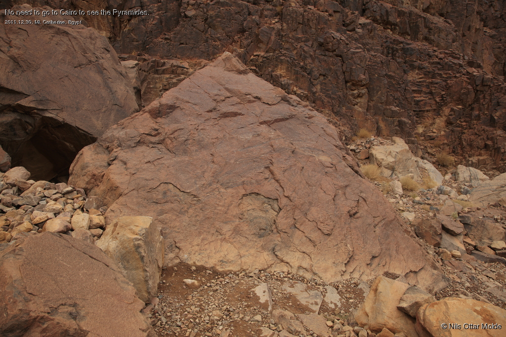
As I came over the shoulder a bit to the south of the eastern summit I found myself in the basin between the west and east summit. I knew that the summit with the millitary installation would be higher than the summit with the monastery. So I went over to this summit first. It was still raining and blowing strong wind. The rocks became surprisingly slippery when wet so I had to be extra careful when walking. The slope to the south and west was much more gentle than the eastern slope I had come up. There even appeared what looked like a dirt road that had probably been used to bring up the building equipment for the installations. I had read that the installations were built by the Iraelis during their occupation of the Sinai after the six days war back in 1967. The summit was rather messy with lots of old debris laying around. Not a pretty sight.

After I had taken som photos I walked over to the other summit as well. The slippery stones and the wind made this an awkward trip. Finally over I snapped a photo and started my descent immediately. I was now freezing so badly on my hands that I was really looking forward to get lower into the gorge, out of the wind.
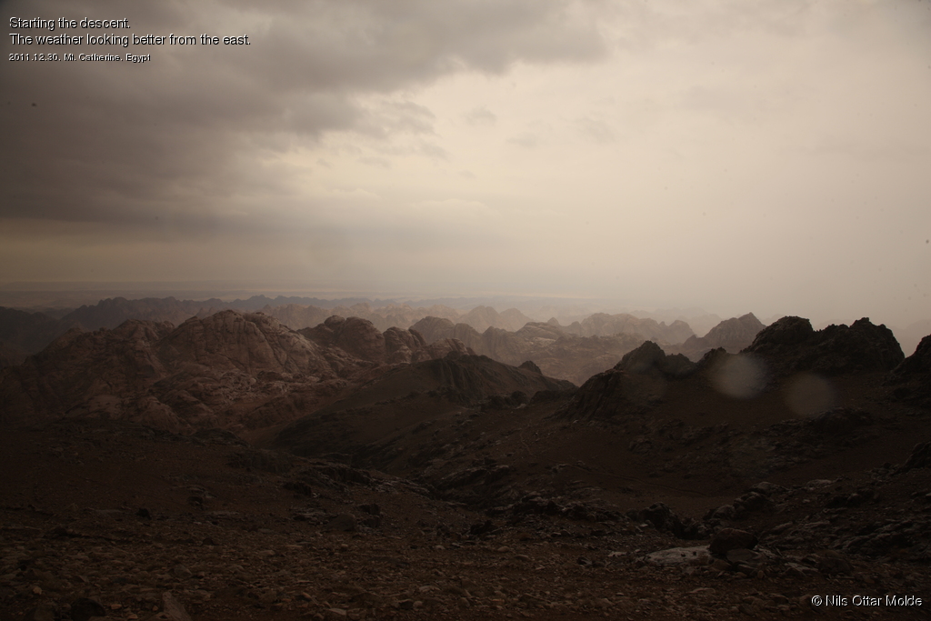
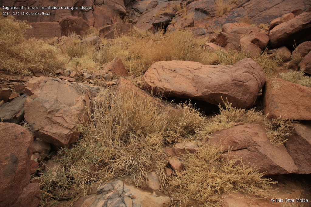
4-500 metres below the summit I was out of the worst of the wind and it also stopped raining. I regained the warmth in my hands soon enough, and could only smile of the fact that the rain had been exclusively when I was above 2.000 m.s.l.. I noticed that the presence of vegetation was stronger the higher I came on the mountain and that is probably explained by the fact that it rains more on the higher slopes.
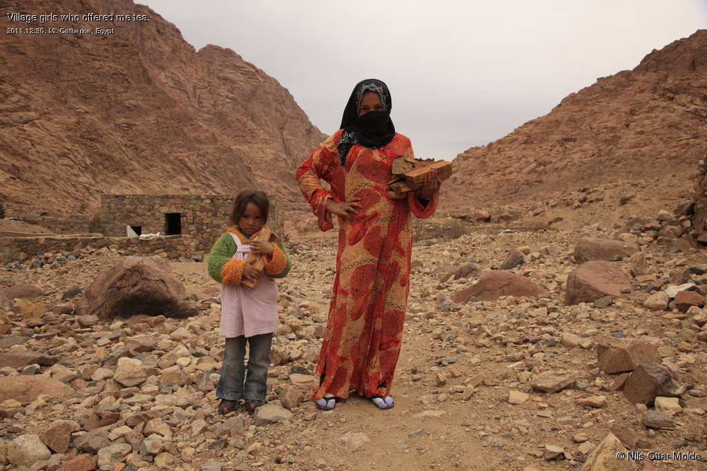
The descent went without any incidents and when I came down to the valley I had a good 10 minutes rest, eating my last Snickers bar and drinking water. When I crossed over to the Mt. Sinai side to ascent up to the saddle I met two village girls who offered me tea. Instead I bought myself permit to take their picture.
After this it was just plodding on to get back to St. Catherine Monastery where I could change clothes and start the drive home. This time I also knew how to take the traverse below the south face of Mt. Sinai, reaching the main trail to the bottom.
I spent nearly 7 hours and 30 minutes on the entire trip. 4 hours nearly to the minute on the ascent and 3 hours 30 minutes on the return. I'm not a very fast walker, but I only had one 10 minutes stop and that was on the return in the valley. I like to keep moving all the time, eating and drinking on the go.
At the trailhead there were some activity in the Tourist Police office but luckily they did not bother to question me about anything. The driver was ready to go so 10 minutes after my return we were off.
Trivia/Reference
Photos marked with Nils Ottar Molde is taken with a Canon EOS-1 Ds Mark III camera, using a Canon EF 24-105mm L IS USM lens.
Here is how the GPS readings we collected during the trip is rendered in Google Earth.
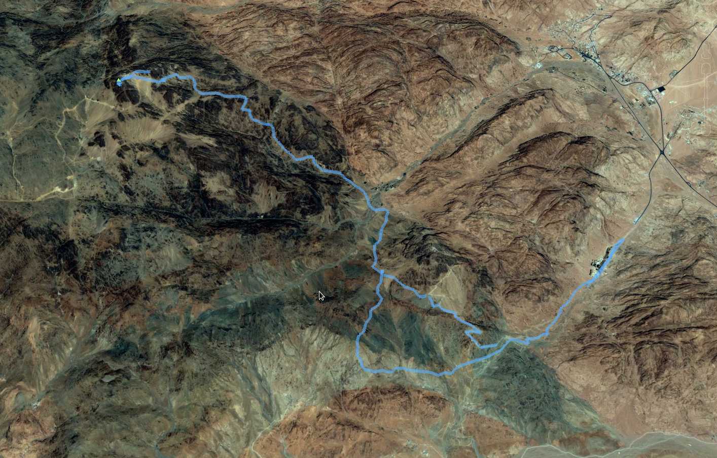
And below is the kml format of the route. Using the GPSBabel software, you could probably convert it to fit into your own GPS device.
This file can also be applied directly into Google Earth so you can view the route from many different angles and altitudes.
Download kml file for Mt. Catherine.