This year we were going to have our fourth holiday abroad at La Manga in Spain. This is a fabulous resort for young children, with swimming as the main attraction. As I was getting a bit restless at the prospect of another go at La Manga, I decided that I would see if there was anything else to be done during the two weeks in Spain. On a hunch I decided to seek out the highest mountain in mainland Spain. (The highest Spanish mountain beeing Teide on Tenerife island at 3718 metres)
To my great pleasure I found that the mountain was named Mulhacen, at 3482 metres, and was situated in the Sierra Nevada, on the south coast of Spain. Estimating that the time to travel with a car from La Manga to the nearest village could be done in less than 10 hours, I set out to find out more about the mountain.
There were not many english sites to be found that described how to reach the summit. I had to be sure that I could do it, as I have no experience as a climber, and scrambling in Norway's Jotunheimen is the toughest "climbing" I have done so far. Luckily I found this page, written by a fellow countryman called Petter E. Bjørstad, and the link to his mountain page is here. Here You will find a description of his trip to the summit of Mulhacen in December 2003. As it turned out, there were no climbing required to reach the summit, when starting from the village of Capileira
I found some rudimentary maps from the area on the internet, and decided that I would start from the village Trevelez instead of Capileira, as Petter had done. Trevelez is situated even higher than Capileira, and the route seemed to be shorter than the route from Capileira.
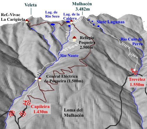
I have a daugther, Sigrid, who at 10 years of age ought to be up for this trek as well. Trevelez is situated at 1500 metres, so the ascent would be ca. 2000 metres. When she was at the tender age of 8, she scaled a nunatak on the Folgefonna glacier (Norway), called Holmaskjera. Starting from the sea level that meant an ascent of 1565 meters. She never complained. Although she did not fall all over herself with joy of the prospect of going to Mulhacen, she did come around to the idea of this "expedition" beeing a great experience. We were ready!
I booked us into a hotel at Trevelez from Tuesday to Thursday. The plan was to use Tuesday to travel from La Manga to Trevelez, obtain maps and figure out from where to start, and do some basic research about the availability of a trail. Then we would start as early as possible on Wednesday, so that we could go for as long as possible before beeing pestered by the sun. Also, after the trip we would definately need a good nights sleep before driving back to La Manga.
With these preparations done, we set out for La Manga in good spirits. There we were to have one week of nothing but sun and sea, and in the second week, Sigrid and I would leave on our "Expedition", and my wife, Helen, and our son, Haakon (7 years of age), would continue the stay at La Manga.
Tuesday at 12:00 we started on our way to Trevelez. We had been to Cartagena, where I had tried to obtain a map of Sierra Nevada with no result. But we had bought us a road map over Spain. We also had talked with some people who lives at La Manga on a permanent basis, and they told us that the trip to Sierra Nevada ought to be done in about 4 - 5 hours. Great news! We drove on a new motor highway for the first 2 hours, seeing less than 50 cars. Amazing! When we entered the old motor highway, the traffic became significantly denser. After another hour we turned off the highway, and headed for the mountains. Soon we found ourselves on a narrow road, with lots of twists and turns, forcing us to reduce speed dramatically. We now had Sierra Nevada on our right hand side, and drove through lots of small villages that were not mentioned on our map. It seemed to take forever, and no Trevelez or Capileira in sight. We got a bit nervous that we had done a wrong turn somewhere, and decided to stop at the next village to ask the locals if we on track. I parked the car, and went out in search of someone to ask. After a few steps I turned to smile and wave at Sigrid, and to my astonishment I could see that I had parked directly under a road sign that bore the legend : Treveles 7 km. And it was in the direction we were going, no less. A huge relief.
Soon we found where the road branched off to Trevelez, and turned into the last leg of our car journey. The mountains loomed hugely behind the village, and there were heavy clouds that hid the peaks. I have to admit that at this point I was a bit worried; It did not look very favourabe to enter the mountains in these conditions, and I hoped for better weather the day after.
We found a place to park our car at the highest plaza in the village, and found that we had used a wee bit over 5 hours to get there from La Manga. Quite a bit less than my initial guess of "less than 10 hours", but beeing from the west coast of Norway, motor highways with a speed limit of 120 is a novel experience. I asked a local for the way to the hotel, and he patiently explained the way in painstakingly detail. I beamed a huge "gracias" at him, and Sigrid and I wandered off in the general direction that we remembered was the first he pointed at. Neither I or Sigrid know the spanish language, but the spanish people we met never took any notice of that, they just carried on like we were born and bred in Spain.
After a climb in narrow, steep streets, we managed to find the hotel, and checked in. Very nice rooms! I tried to ask the receptionists if she had a map of Sierra Nevada, and if there was a trail to follow, and , if so, where did it start from. I think we agreed upon the fact that she did not have a map, and the rest of the conversation sort of drifted away into "no comprende" country ... But she pointed out on a small map of the village where we could try to find maps of the mountains. We set out with high hopes.
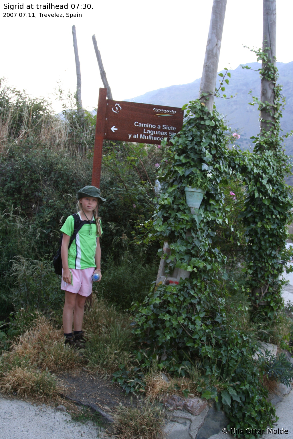
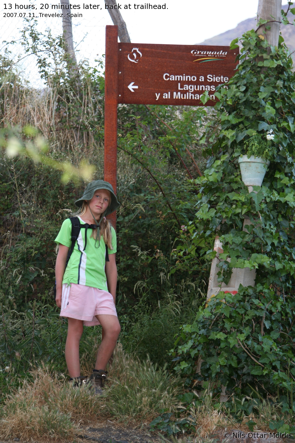
At the main plaza there was a souvenir shop. We entered, and luckily they had one copy left of the map of Sierra Nevada. It was in german, but that was perfectly OK by me at this stage. The two young ladies at the counter managed together to explain to me that there was a trail to the top, and where it started from. They told us that the trail started less than 50 m from the hotel, just going further up the streets. We bought some bread and bananas for the trip, having stocked up on everything else beforehand, and went to finish our research by locating the trailhead. It turned out to be no problem to find at all behind the hotel, at the very end of the village, and finally I could relax, leaving the weather as the only variable out of my control. The sign at the trailhead bore the legend Mulhacen 8 hours, Siete Lagunas 6 hours.
We went to the hotel restaurant for an early dinner, preparing for an early evening. The food served at the restaurant was a very pleasant surprise. It was by far the best food I have had in Spain, and at half the prices charged at the restaurants in La Manga. Recommended! After this great meal, it was back to the room, preparing for sleep.
I figured that if we travelled at a moderate pace, 250 metres per hour would be a reasonable estimate. Then we would use effectively 8 hours to reach the summit. If we used half the time down, that would be 12 hours. Adjusting for time at the summit + some extended breaks for food, it seemed possible to do the whole trip in about 14 hours. The thing is that in Spain in the summer it gets dark at about 22:00, and VERY dark at about 22:30. In Norway it is no problem walking around at night in June/July, due to Norway beeing much further north. If we calculated backwards from 22:00, we needed to be on our way at 08:00 at the latest!
I set the timer on my mobile phone to 05:00, having no idea what time it would be enough light to start. Although I had been in Spain for 1 1/2 weeks, I had not made the effort to check this. I slept very light due to some excitement caused by not knowing much about what it would be like the next day, and woke the first time at 03:00. It was pitch dark, and I went back to sleep. At 05:00 it was still pitch dark, and I set a new alarm at 06:00. At 06:00 there might have been a slight shade of dark grey, but I decided to wait another half hour. At 06:30 I woke Sigrid, and we decided to get dressed, and review our equipment.
As I have said earlier, we did not know much about what came next. Would it be cold and windy at the top? Would there be drinking water to be found? Would we make it back before it got dark? The only thing I remembered reading was that it was essential to bring water in the summer, because there might be no water on the mountain. Preparing for the worst, we packed the following items : We each carried a 1/2 litre bottle of water in our hands, and I carried a GPS receiver as well + a Canon digital SLR camera.
- My backpack
- 6 litres of water
- 1 bread
- 4 bananas
- 4 apples
- 30 Kellogs energy bars
- 1 bag of cashew nuts
- 1 bag of dried fruit
- 1 bag of m&m chocolate
- 2 windbreaker jackets
- 1 windbreaker trouser (for Sigrid)
- 2 fleece jackets
- 2 strap on head lights
- 1 emergency kit
- 1 roll of toiletpaper
- Additional batteries for head lights + GPS receiver
- Sigrids backpack
- 2 bottles of Powerade sports drink
- 1 bag of cashewnuts
- 1 packet of papertissues
I have never carried such a heavy backpack on a (presumably) day trip before, but this was a trip that I would not be unprepared for!
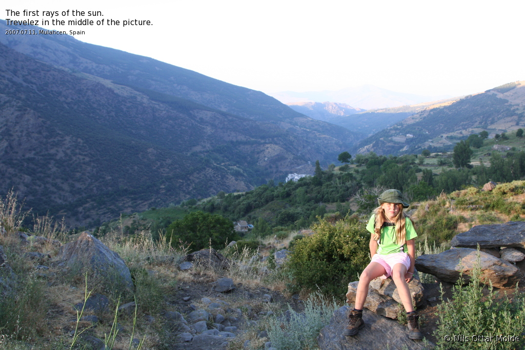
We had a light snack of Kellogs energybars and apples, drank a lot of water, and set out. We were at the start of the trail at 07:30, and we could already see the sun shining on the mountain we were to climb.
As we started out, I soon could see on the trail that someone had started out just before us, and in a little while we could make out 3 figures ahead of us on the trail. It seemed as if the had started about 15 minutes before us. The start of the trail was fairly easy going, with quite a few trees, and pastures. It was a very nice temprature of about 15 C. We were both dressed in T-shirts and shorts.
After about 30 minutes, another trail branched of to the left, going steep uphill. There was a sign there bearing the legend "Siete Lagunas" only. Now where did Mulahcen go to? Carry on forward into the valley even further before turning uphill? We did a mistake here and carried on. After 10 minutes I was so worried that I said to Sigrid that we had to turn adound. After all the track we were supposed to follow, should bring us to the Siete Lagunas as well, before the final push to Mulhacen. We turned around, and as we went back, we could see the three persons that had started ahead of us, further up the trail marked Siete Lagunas. We wasted 20 minutes on a wrong desicion.
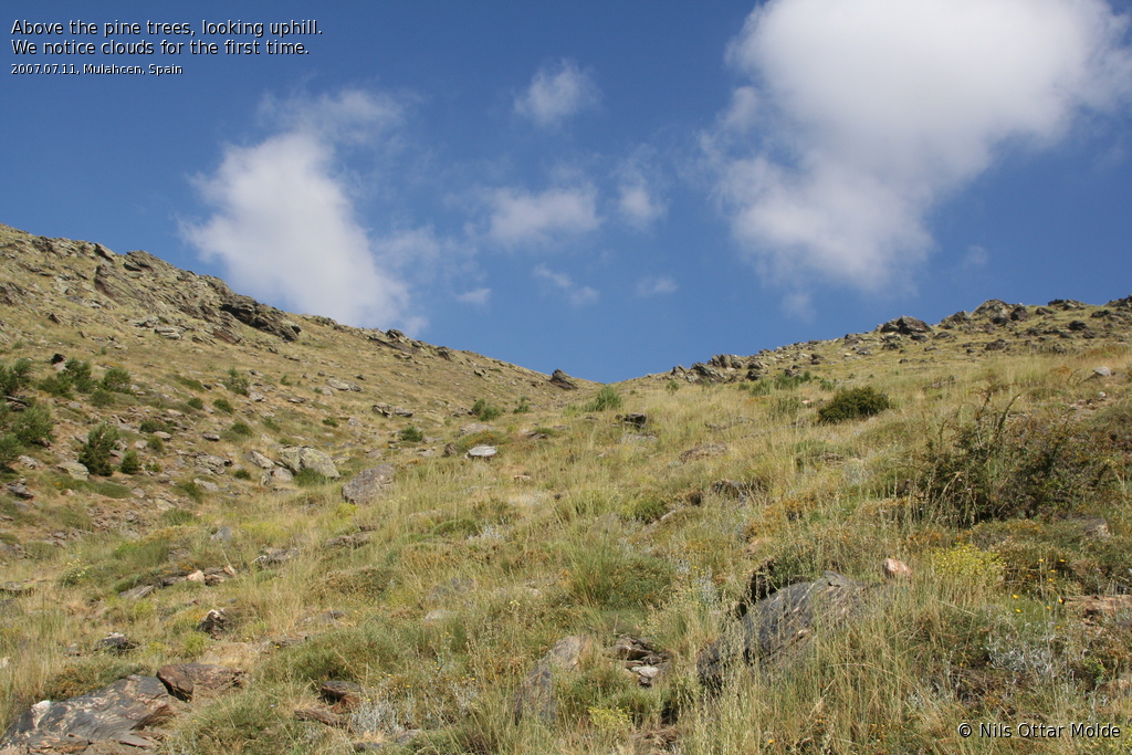
Now the trail was a bit steeper, but still easy going. Sigrid complained about some discomfort on one of her heels, so we quickly put on blister pads. After one hour, we had advanced nearly 300 meters in height, and the sun was closing in. The trees disappeared, and the vegetation was mostly grass. There were lots of grasshoppers and other insects, but none of the really pestering types that insists on crawling into your eyes, ears and mouth wen you are sweating uphill. A slight breeze made the going pleasant.
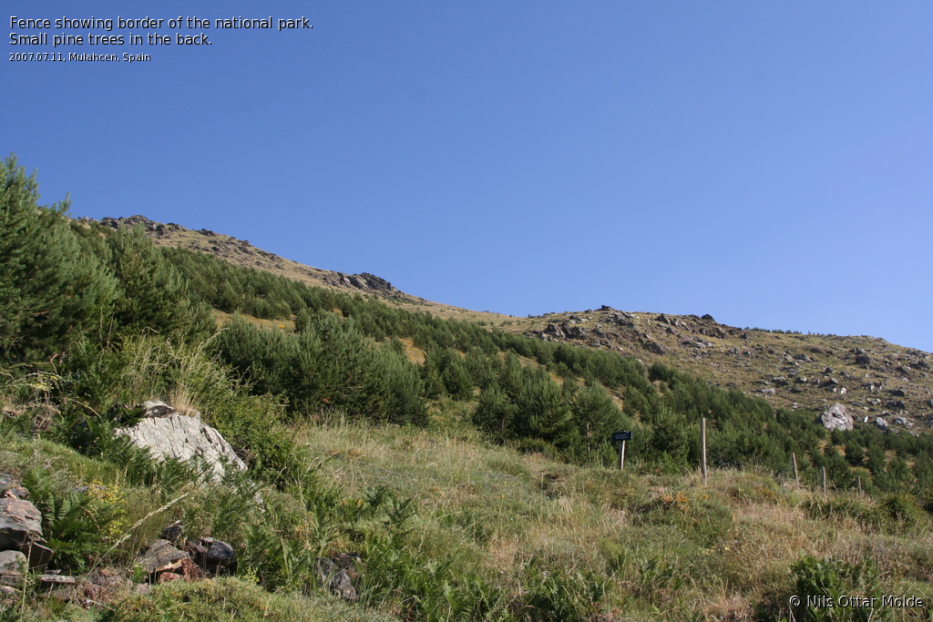
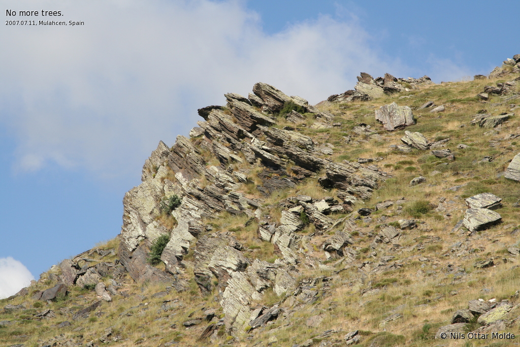
Two hours up, we had gained 500 meters, and the sun broke over the neighbouring ridge starting to warm us up. Still the breeze kept the temprature well within tolerable limits. We came upon a nice brook, with plenty of water. We also came to a sign telling us that we were now entering the National Park of Sierra Nevada. Now a small forest of pine trees appeared, but the trees were mostly so small that they did not cast any significant shadow.
Sigrid complained about her other heel, so we put on blister pads there as well, taking no chances. During a rest we saw the first people behind us, down the trail. The going was alternate steep up the mountain, and then alongside the mountain, giving us a nice easy walk.
Tree hours up we had gained about 750 meters. We kept the scheme nearly to the meter. The pair we had spottet below us, came alongside. They were an English couple in their thirties, and their destination was Siete Lagunas. They had been to Mulhacen summit earlier, and would not repeat this today.
Sigrid spotted a lizard scuttling along the trail, and alerted me. It was impossible to get a picture on the reptile as it suddenly became aware of us, and leapt into the bushes. It was a fun episode though.
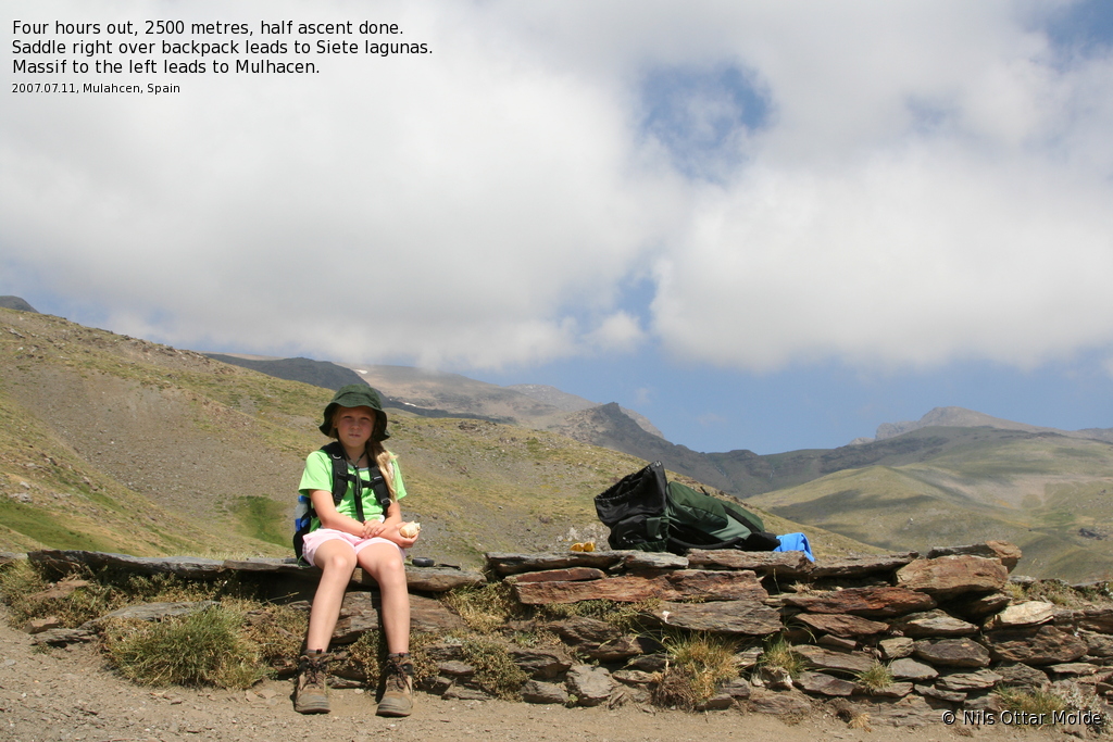
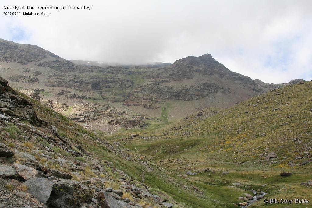
At four hours we came over a ledge, and got a great view of a valley going off 90 degrees from the one we had followed so far. At the bottom of the valley, a healthy stream ran, and in the start of the valley we could make out a steep rise to the edge of what i estmated was the Siete Lagunas. To the left of this rise, the massif rose higher, and we knew we had to scale that massif to get to Mulhacen. We had a good rest here, eating some bread and bananas, and stretcing our legs. We were now 1000 metres higher than when we started out, and at 2500 meters we had never been higher. My previous record was Galdhøpiggen, Norways highest mountain at 2469 meters. This of course added some extra excitement to the overall feeling.
As we sat there a young couple came up the trail. It turned out that they were from Norway, and were going for the top. They gave Sigrid a great cheer for going on such a long trip. They were very fit, and we soon lost them out of sight.
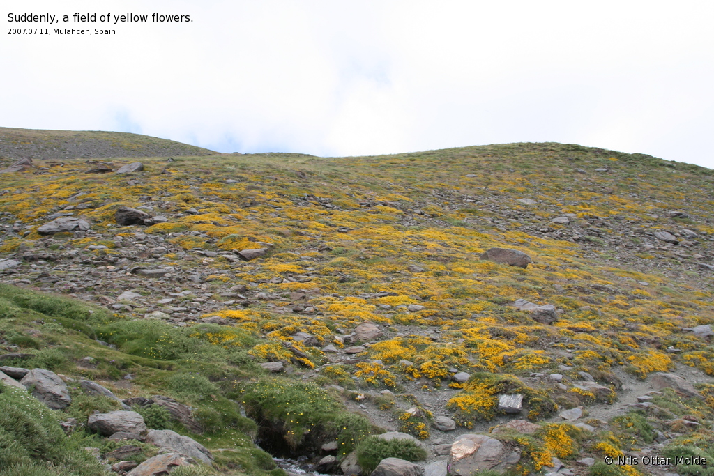
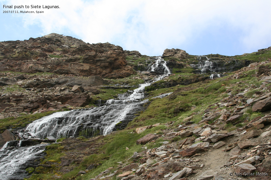
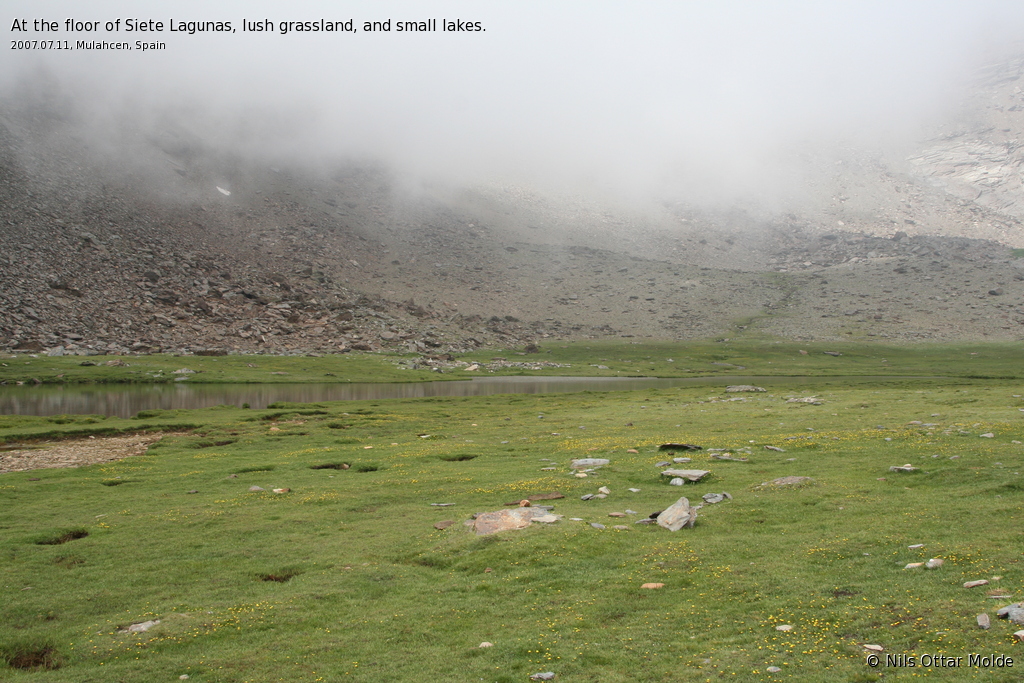
The next hour was an easy trek into the new valley. The vegetation were now only grass, as all signs of trees stopped at 2500 metres. At the end of the valley we encountered cows, but they were friendly (or rather indifferent) to us. The steep rise up to the Siete Lagunas was a welcome divertion, and it was a beautiful place, with the trail going up between two waterfalls coming over the ledge above.
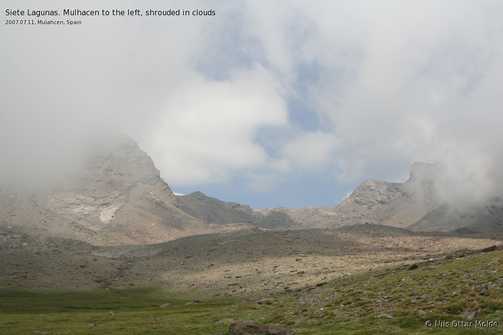
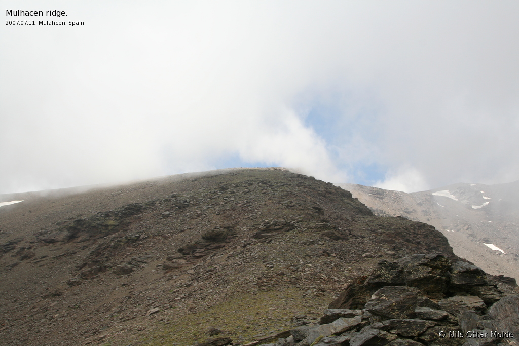
At this stage the clouds were thickening, and the temprature was so moderate, that Sigrid put on the fleece jacket when we had breaks. I wondered if the day would turn out to be like yesterday, with heavy clouds shrouding the top of the mountain. Well, we were going for the summit anyway. I have been to summits before, and had the visibility of about 10 metres, but that did not dampen the joy of beeing there!
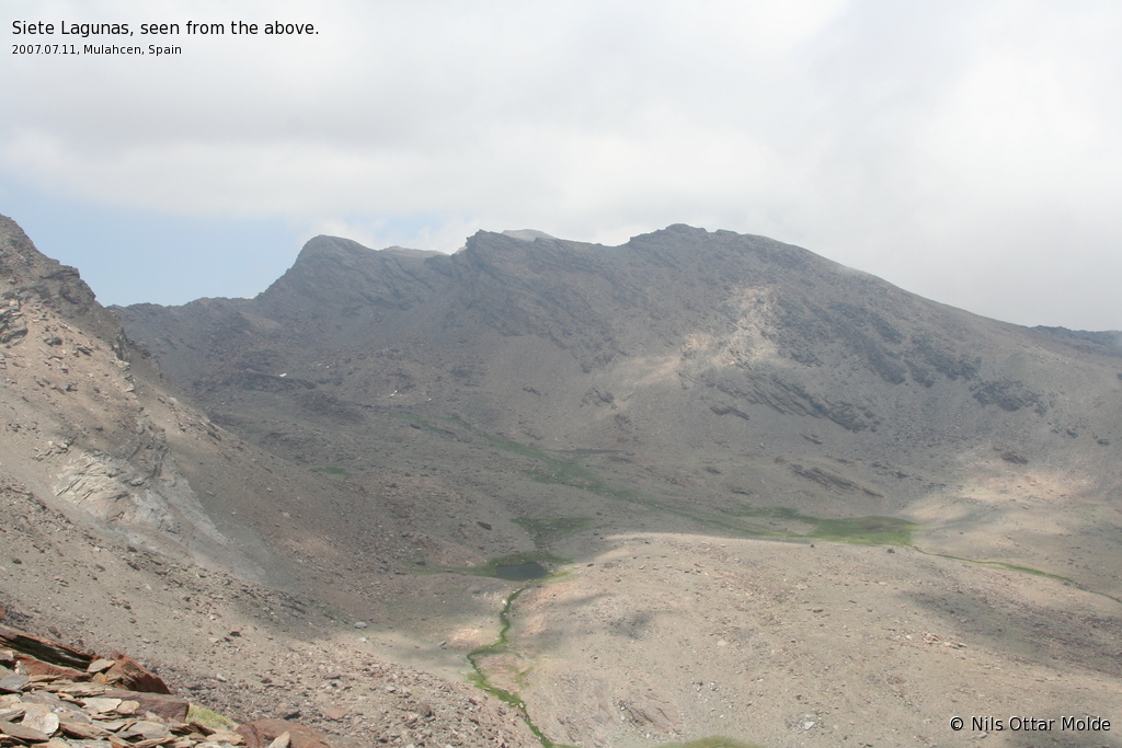
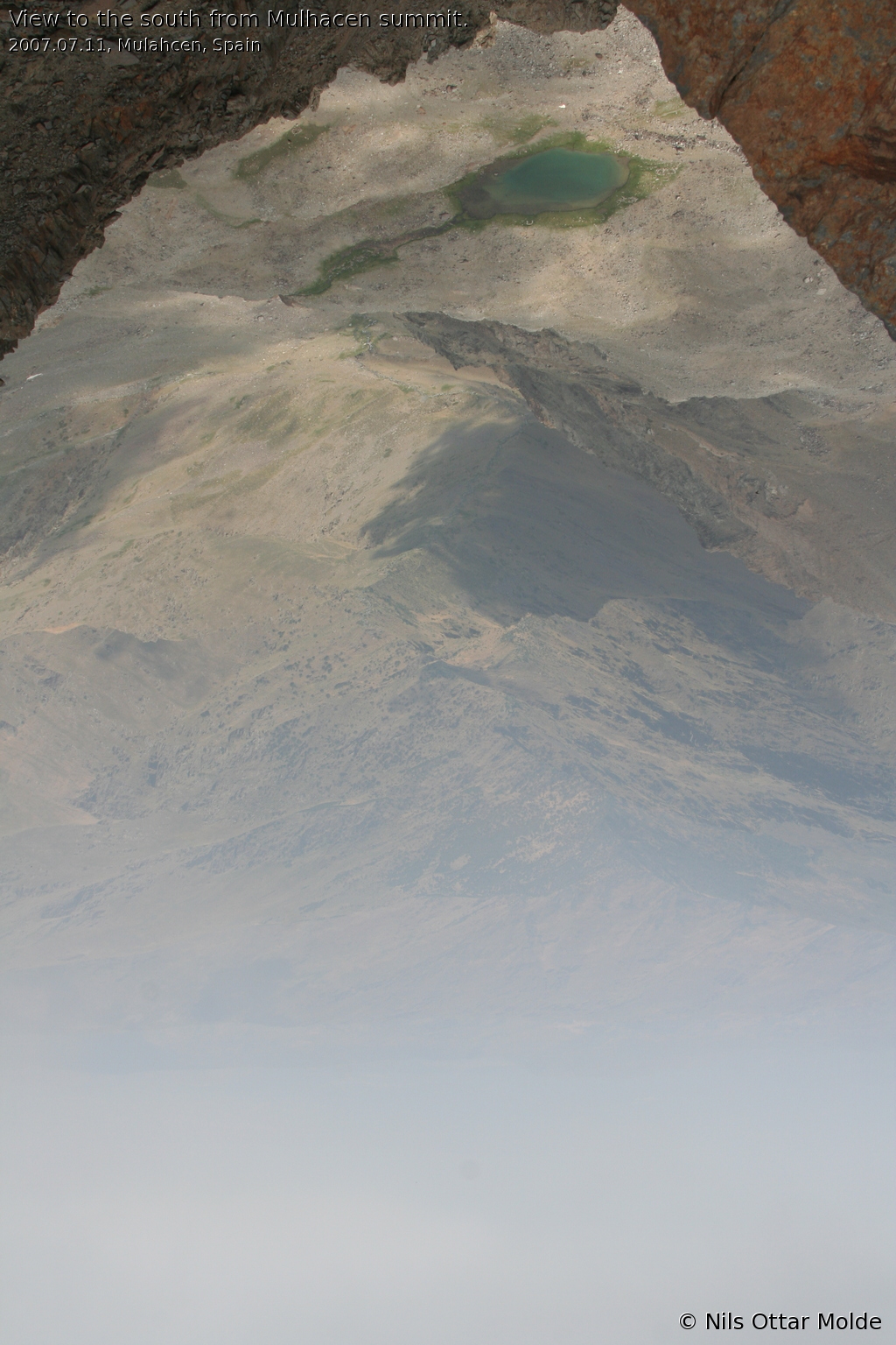
After we got over the rim where the waterfalls started, we were at the Siete Lagunas. This is a vast basin, with hight mountains both to the left and right. In the bottom of the basin there were some bodies of water, and very green grass. Clouds shrouded the massif to the left, where we knew that the summit were. We had a long break here as well, refuelling ourselves with fruit, bread and chocolate.
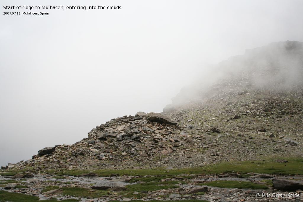
The trail picked up again on a steep rise on the left massif, and we were starting to push onward, when we met a group of 10 people coming down. One of them knew the english language and we had a chat. The were spaniards who were trekking in the Sierra Nevada. The person I spoke to had recently been to Norway he told me when he knew we were Norwegians. He had been to "TRISIL" (Trysil), skiing. When he heard that we were going for the summit, he warned us not to be late on the mountain. When I told him what my backpack contained, he smiled broadly, and said that he would not give me any more advice, as it seemed I had prepared very well for this trip.
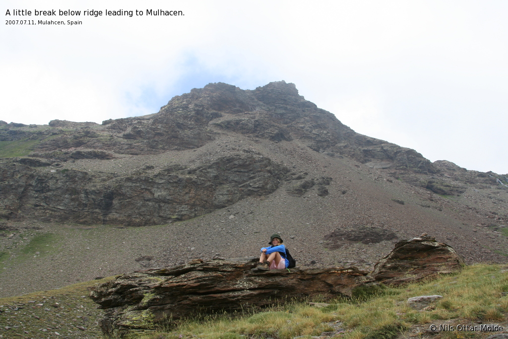
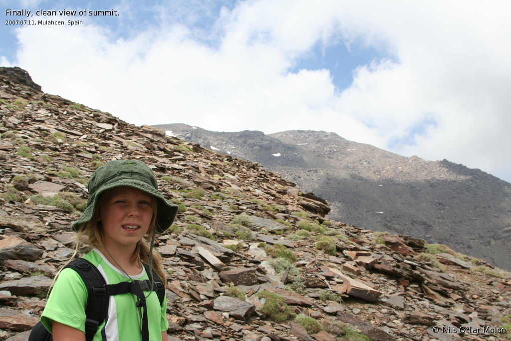
After ascending the steep rise, we found ourselves at about 3100 metres, and we had a break. We still could not make out the summit, but the trail was well defined. At this point nearly all vegetation was gone, and the environment was rocks only. It reminded me of the top of Hallingskarvet.
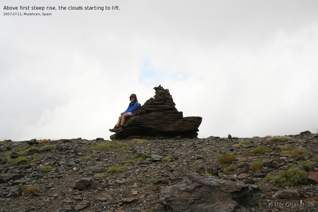
As we were enjoying our break, sitting down, I suddenly realized that I did not get enough oxygen. I had to rise to my feet, and force a couple of deep breaths. That did wonders, but then I knew that we were so high that my body started to feel the effect of the thinning air. I kept remembering to breath deeply on the rest of the ascent. Sigrid was cool, and said that she felt fine.
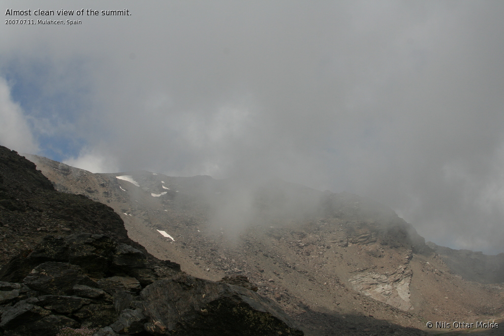
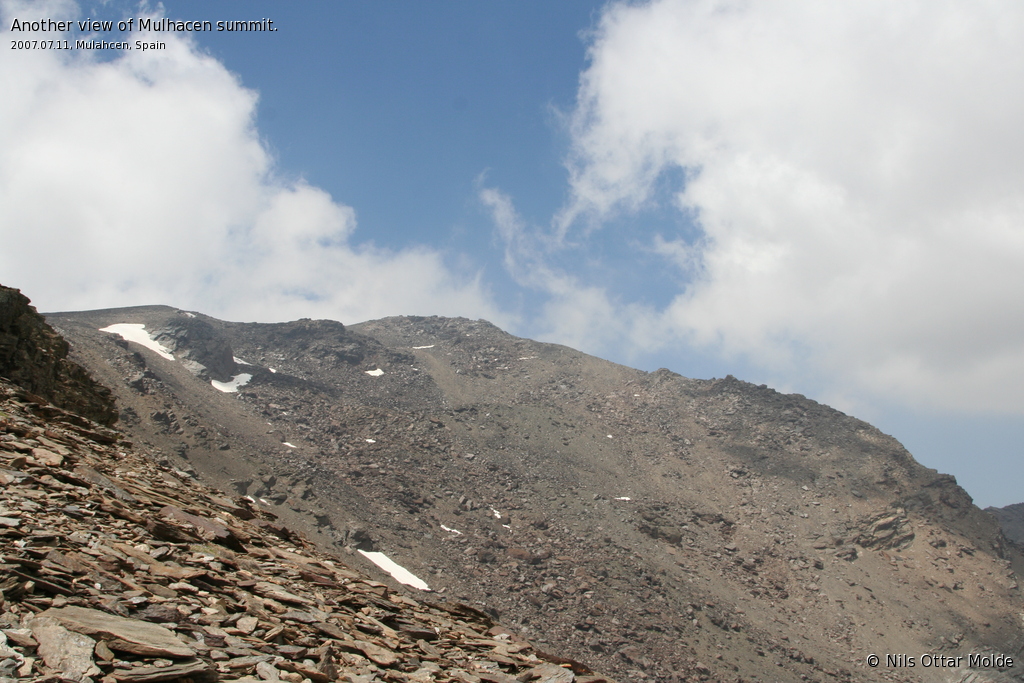
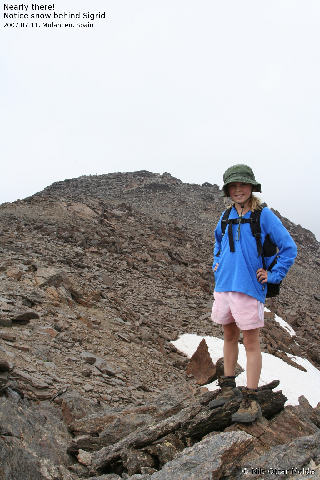
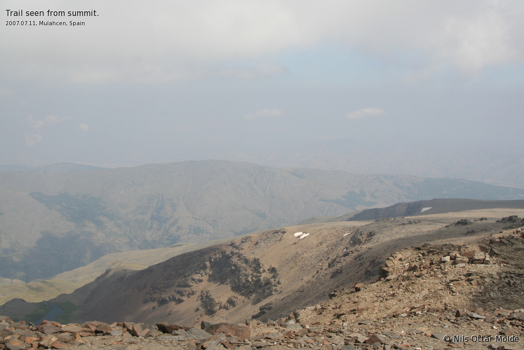
As we went on, the clouds lifted, and we had a magnificent view of the Siete Lagunas basin to our right, and suddenly, the summit was in view. The GPS now told me that we had less than 400 meters to ascend. If it was the thinning air, or the lack of vegetation, it looked sooooo long to the summit. I really had doubts about the GPS showing the corrent altitude, but as we approached, I saw that it had to be correct. The funny thing was though, that when the GPS said 400 meters left, I would have estimated 600 metres, when it was 200 meters left, I would have guessed 400 metres and so on.
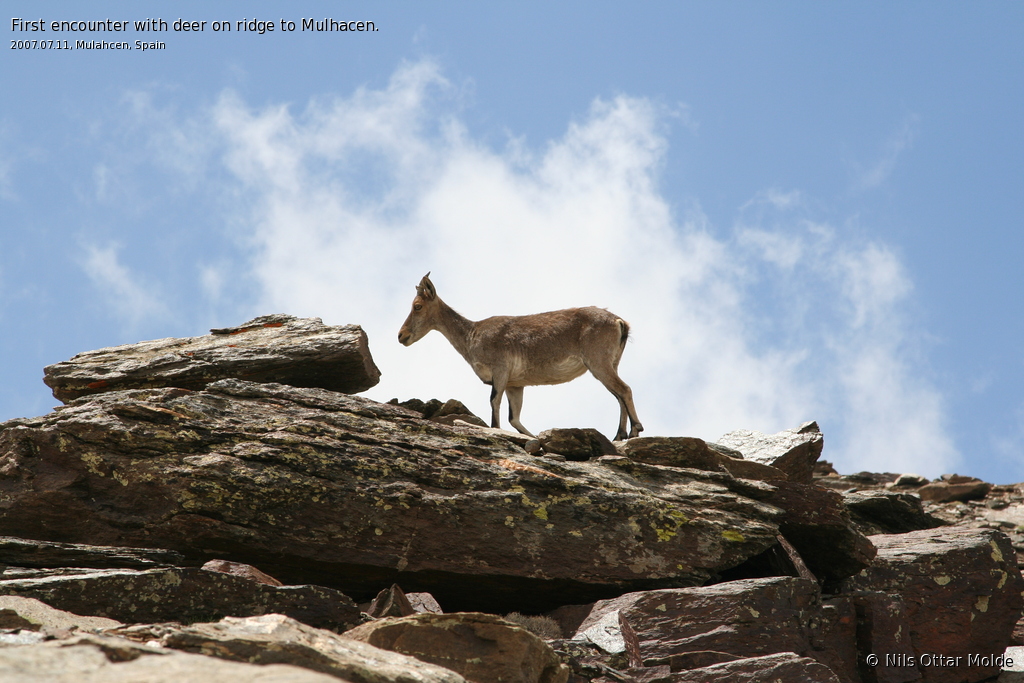
Halfway up the final ridge, we encountered two deers. They did not seem particularly afraid of people, and we got pretty close to them as they were directly on the trail. We met the young Norwegian couple on their way down, and they could tell that on the summit there were several more of the deer, and that they were "begging" snacks and food from the people there. They could also tell that on the summit, there had been almost no clouds, giving them a fine opportunity to enjoy the sun as the rested there.
I will not lie and say that the final 300 metres was easy. We had many short breaks, but managed to scale the final 480 metres in just over 2 hours.
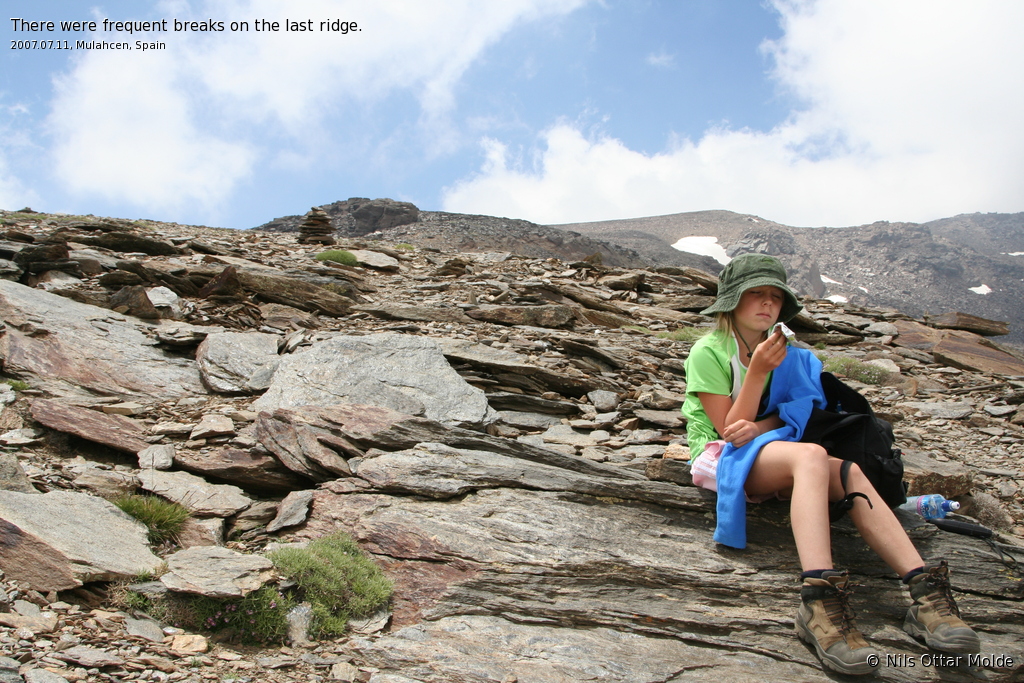
Finally we reached the summit, 9 hours after we set out from Trevelez, at 16:30. We now had 5 hours and 30 minutes until it would be dark. Very dark.
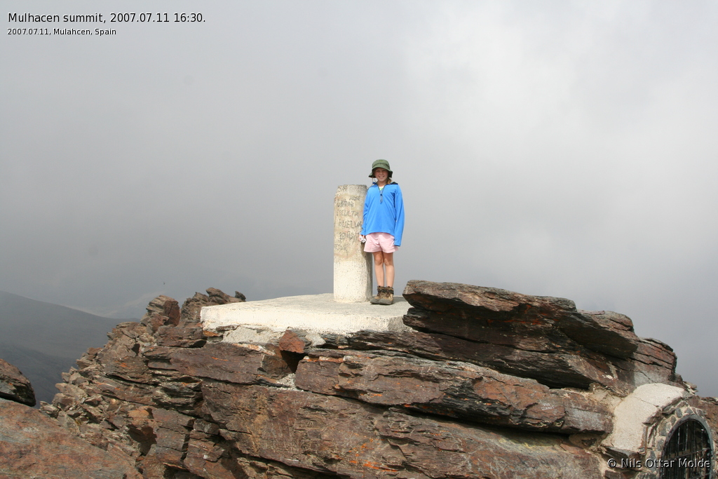
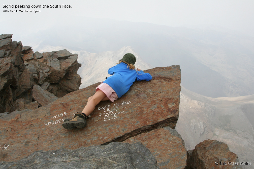
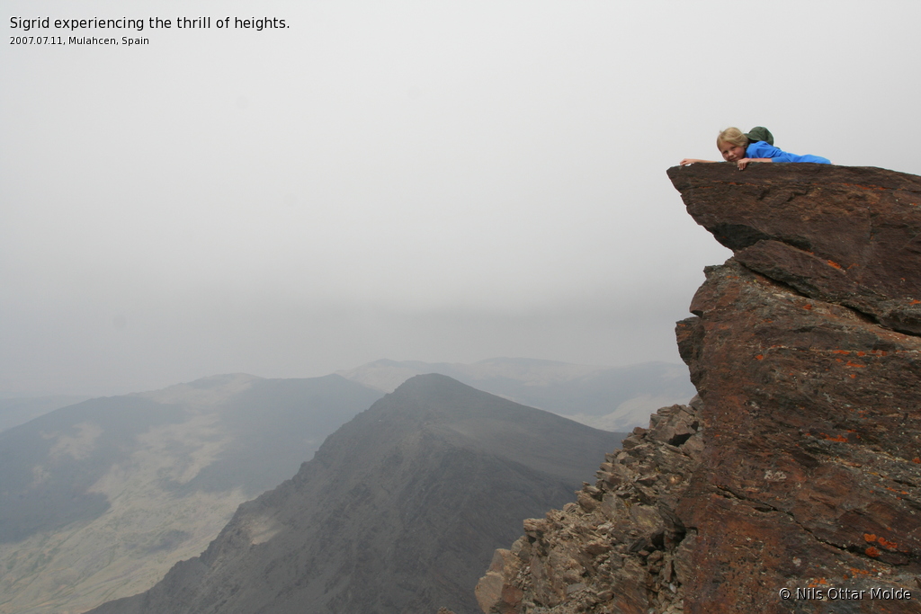
At this time there were only one person at the top apart from us, and the whole time we stayed there, no one else arrived. Now it was time to get our pictures taken at the high point. I took pictures of Sigrid, Sigrid took pictures of me, and the Italian tourist took pictures of both of us. As we looked around, we realized that if you took two long steps from the high point, you would find yourself in the free air, starting a drop of several hundred meters. It was a spectacular sight all around, and the clouds had all but lifted. Sigrid climbed out on the cliffs, laying facedown over the ledge, and I took several pictures of her that she looked forward to present to her mother. This would get the blood racing.

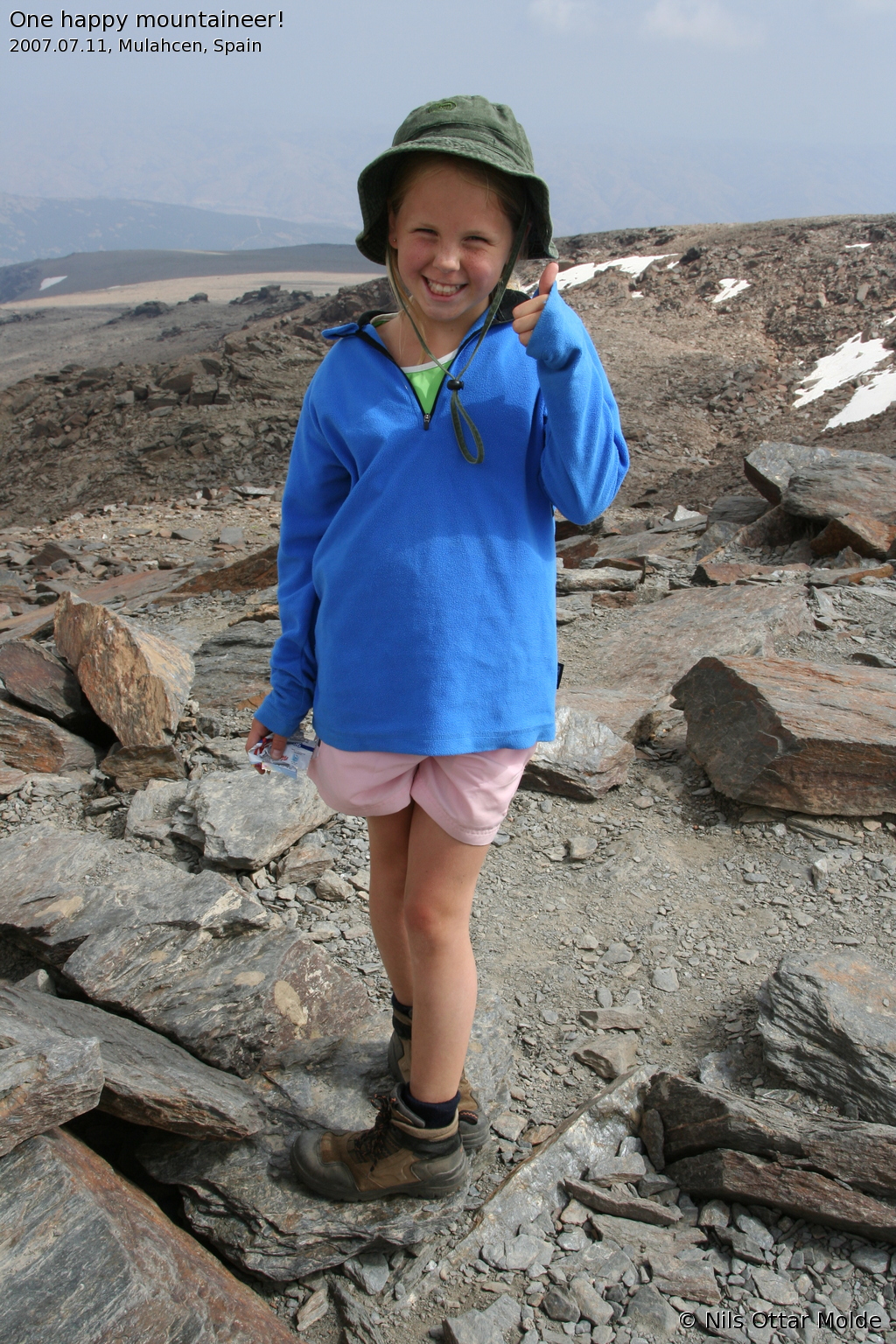
We stayed at the summit for 30 minutes, enjoying the view, and having a snack. Sigrid tried to get close to the deers, feeding them Kellogs energy bars. At 17:00 we started the descent.
Not much to say about that really. We used 4 hours nearly to the minute to get down again to Trevelez, having only one break at 2500 meters. This meant that we had 1 hour left before it would be dark. Good margin I would say!
What never stops to amaze me though, is how much longer the distance feels on the way back to the trailhead than up to the goal of the journey. We thought it would never end,but of course it did eventually.
Back at the hotel, we showered, changed clothes, and went to the restaurant for another excellent meal. I told Sigrid that she was lucky. At her age, all she need is a little rest, and then she is fit as a fiddle again. As we descended the stairs of our hotel, she would jump around like a rubber ball, lifting her knees to her chin for each step, daring me to do the same. I passed on that offer.
At the restaurant we met "TRISIL", the Spaniard we encountered at 3000 metres. The group he belonged to had decided to stay the night at the hotel. When he heard that we had made the summit, he grabbed Sigrid by the shoulders, and led her over to the table where the rest of his group was located. There he told them about the feat that Sigrid had done today, and the whole table cheered, clapped, and showed thumbs up. Sigrid did not know what they said, but she understood perfectly well what they meant. She grew an inch as I watched. I would lie if I said that I did not feel a bit proud on her behalf at that moment. And at the same time I was wery happy for the feedback she got from (relatively) strangers, knowing that for her it carried more weight, than the praise I gave her as we came down from the top.
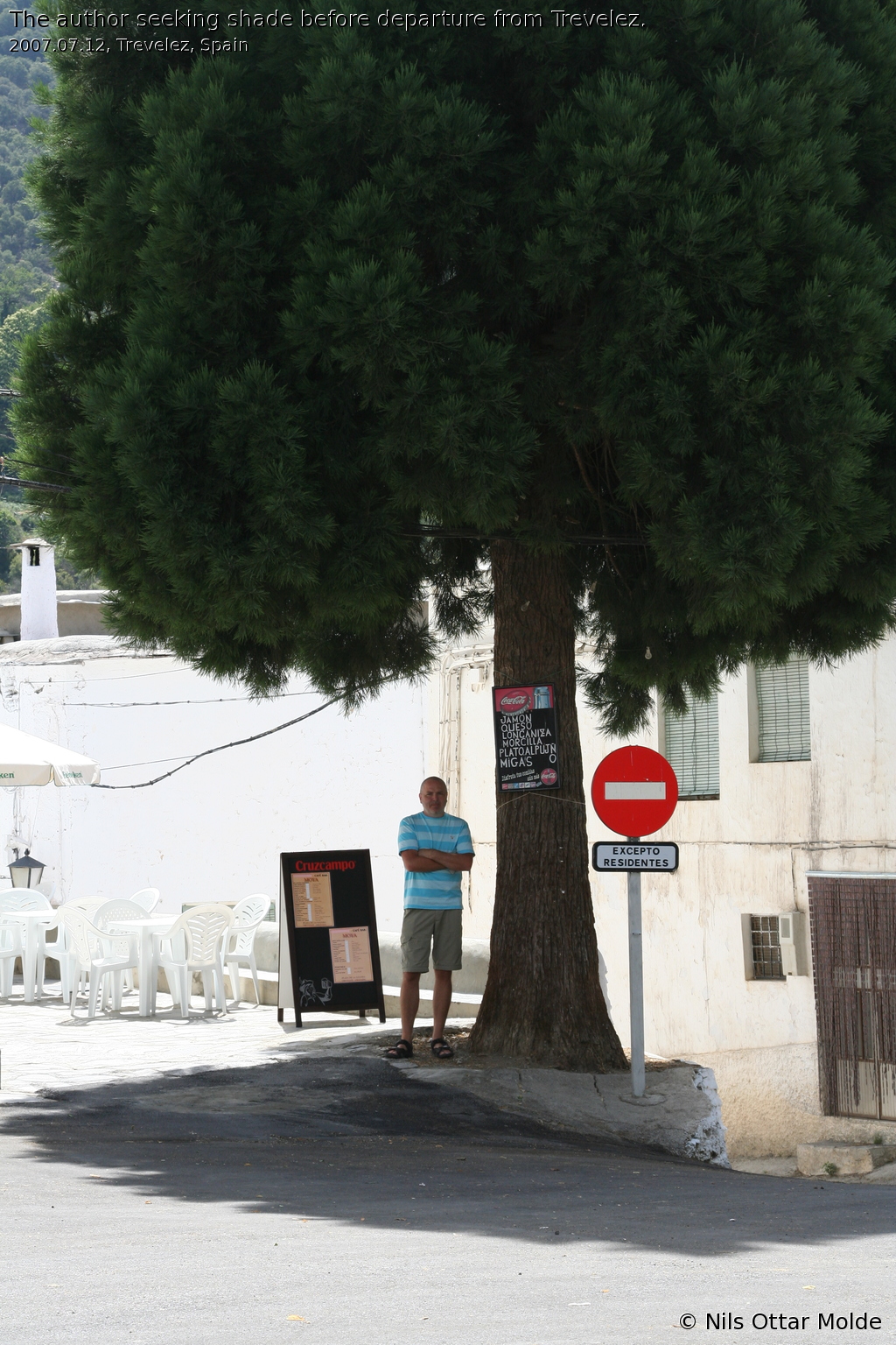
After dinner, it was straight to bed, and a long night of sleep, before starting on the (rather boring) journey back to La Manga.
This was an experience I would not be without. As for people wondering how the trail is to the top, there is not a single point of climbing. Not even at the steepest parts were we forced to use or arms to help us along. So the trail should suit nearly all who are fond of trekking in the mountains. The only challenge is the length of the trip.
Trivia/Details
Photos marked with Nils Ottar Molde is taken with a Canon EOS 350D camera, using a Canon EF 24-105mm f/4 L IS USM lens.
Here is how the GPS readings we collected during the trip is rendered in Google Earth Plus.
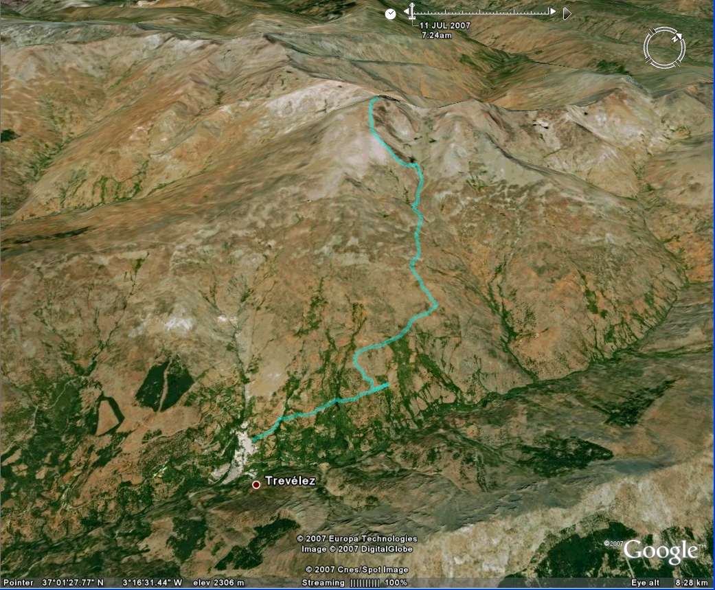
And here is the kml format of the route. Using the GPSBabel software, you could probably convert it to fit into your own GPS device.