Content
A bumpy start (again)
The vacation this summer was to be put together with everybody's wishes beeing cared for. The children wanted to go to Scotland to visit the Harry Potter train that runs between Fort William and Mallaig. (Correct name is "The Jacobite (Steam train)"). From there they wanted to go to the Harry Potter castle in Alnwick. When dad heard of this he could not fail to notice that Ben Nevis, the highest mountain in Scotland, yes, in fact the whole of UK, is located at Fort William. This put the proposition of going to Scotland in a brilliant positive light immediately. So it was very easy to reach consensus that the first week of the vacation was to find us in Scotland and the north of England.
If you do not have read the trip report from 2010 to MtDamavand you will of course not know why I have written (again) about the bumpy start, but this time was off on a bad start as well. The weather in Scotland is not much better than what we have where we live, the west coast of Norway. So we were of course checking the weather forecast often as the departure approached. We were to start our journey on Sunday morning travelling by plane to Aberdeen, and from there drive to Fort William, The weather forecast showed Monday as the only day of the upcoming week with sun and no rain. The rest of the week was a bit miserable. So when the flight from Bergen to Aberdeen was cancelled and we were rescheduled to the day after I felt the chance of bagging another "highest mountain in ..." begin to slip from my fingers. Anyway, the next day we still brought with us hiking gear although the schedule now did not actually include the trip to Ben Nevis.
Tuesday in Fort William turned out to be cloudy with showers and the odd ray of sun. So we all did what was the first priority of the day and went for a ride with the Jacobite Steam Train. When the trip was done we were back at Fort Willam at about 17:00. The weather looked about to take a turn for the worse with more heavy clouds and rain stacking up in the horizon. But I decided to have a go at Ben Nevis anyway. Sigrid and I went into a grocery store and bought sportdrinks, raisins, nuts and bananas and Helen and Haakon would explore Fort William before going back to the hotel.
Finding the place to start the ascent turned out to be unnecessary difficult. A tiny sign by the road was all that showed the way to the trailhead, which I found ridiculous ... going to Ben Nevis is why a lot of people come to Fort William I guess, so why try to hide the trailhead? Possibly my level of perception was a bit below normal because I was using more than ususal of my mental capacity in the effort of driving on the "wrong side of the road".
The mountain
Anyway ... at 18:15 we had found the trailhead, parked the car, changed into trekking gear and was starting out. I had estimated 3 hours to the top and 2 hours down. This would find us back at the car at 23:00. The following evening I had noticed that at about 23:00 was the time when the light for walking on the mountain would be gone. In preparation for this we had bought a headlamp just in case. The weather had improved somewhat. Still clouds but no rain at the moment.
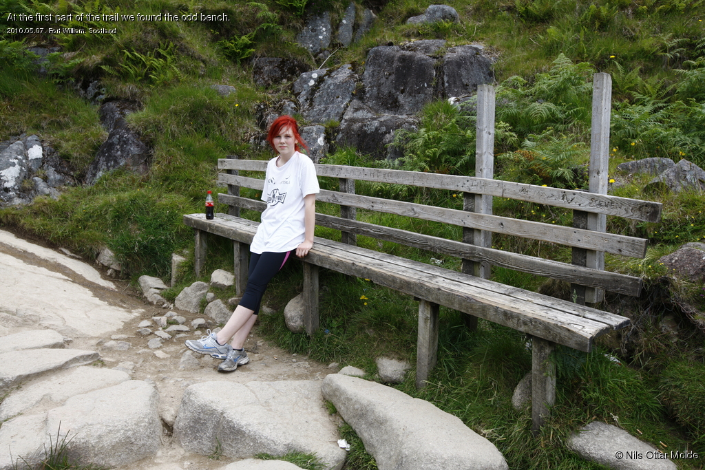
There were about 5 more cars at the trailhead so we figured out that there were people on the mountain still, coming down. The trail was from the start very easy to follow. It was a well maintained distinct trail all the way apart from the very top of the mountain, where the vegetation were nonexistent. But the trail at the top was well marked with huge cairns set comfortably close to each other.
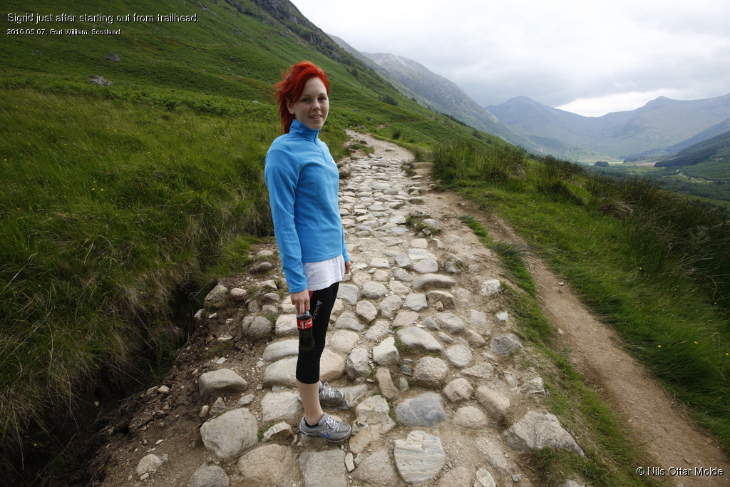
The climb was very moderate all the way so this is a trail that anybody with a bit of stamina may safely walk. Below is a couple of images from the first part of the trail.
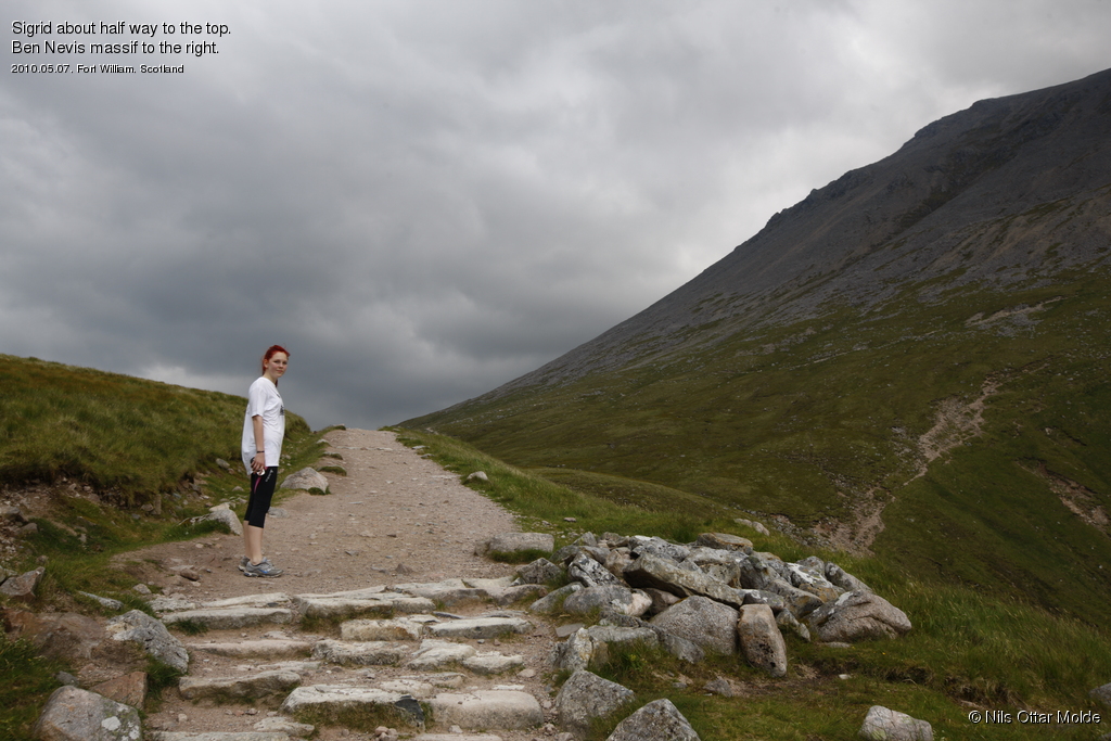
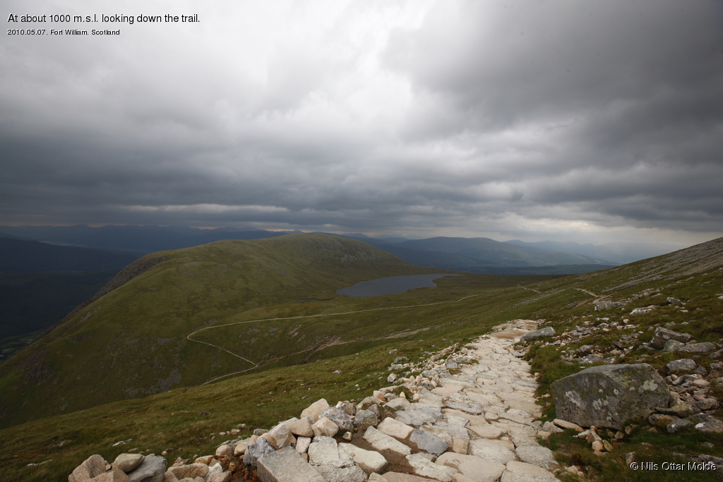
We met many people coming down as we travelled uphill. There were a huge variation of all parameters like age, shape and gear. Some smiling but surprisingly many with grim determination etched into their faces. They were the ones who perhaps ought to be better prepared for such a trip.
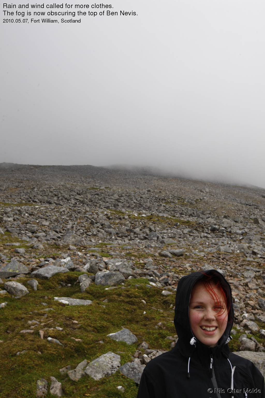
As we came higher the wind would become stronger and colder and we had to stop and put on more clothes. As we passed 1000 m.s.i. the rain visited us again and fog started to descend on the top. Shortly after this we met the last of the people coming down, and we now had all of Ben Nevis to ourselves.
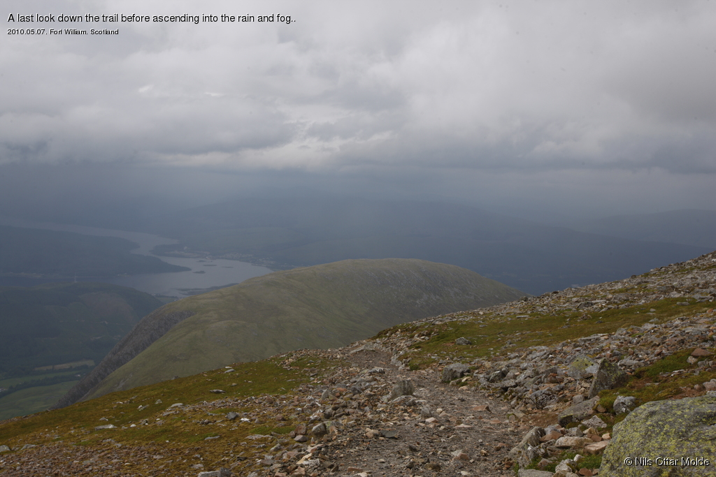
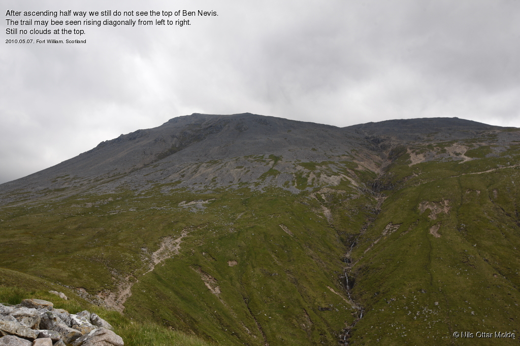
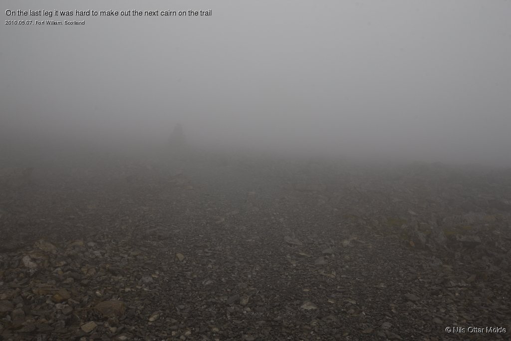
As the vegatation yielded to rocks the trail became increasingly more difficult to follow. The condition with fog at this height is not uncommon. Not long after we entered the fog, a chain of cairns had been erected that led all the way to the top. The light was still good so there were not any problem with staying on the trail. We even had to pass over a large patch of snow in the middle of the trail.
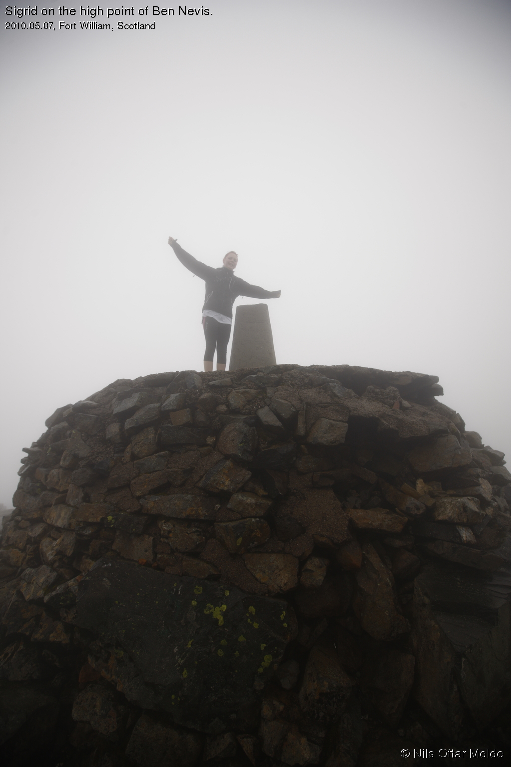
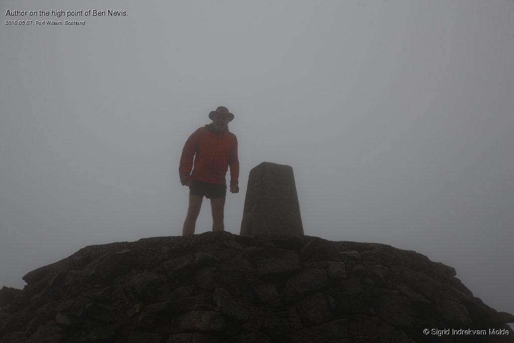
Finally we were at the high point of Ben Nevis, wich was clearly marked with a huge cairn. We climbed the cairn and got our pictures taken. We had used 3 hours and 4 minutes from the trailhead to the summit. So far my estimate was on the spot.
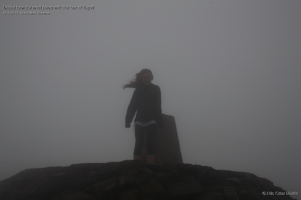
The wind and the rain did not invite to an extended stay. A quick examination of the ruins of an abandoned weather station and then heading down. We also had the issue with the light as we started out very late in the day.
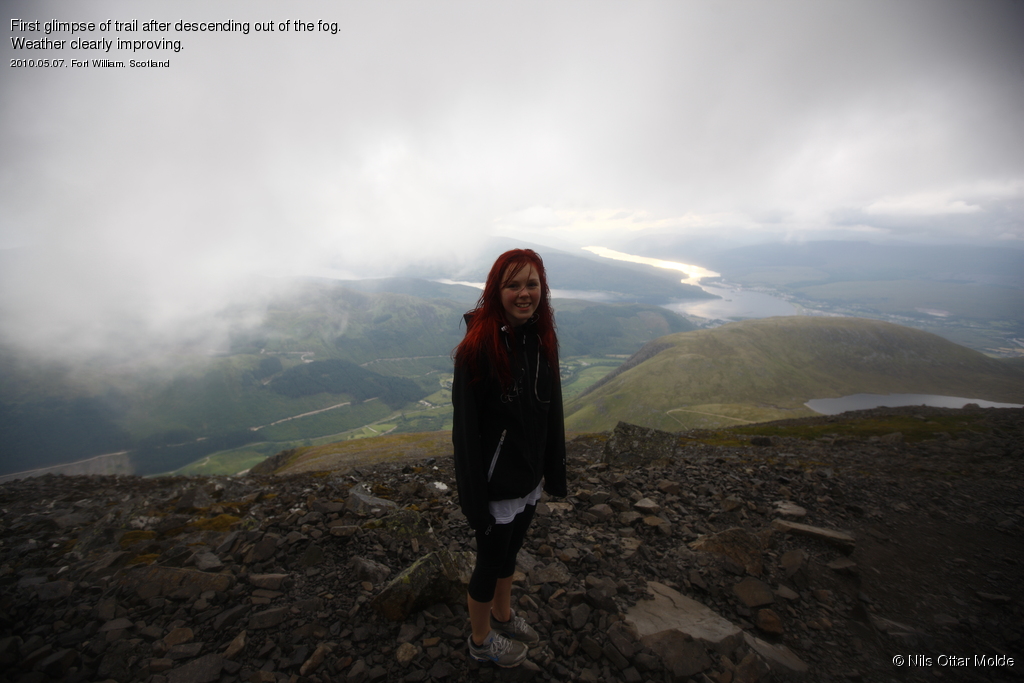
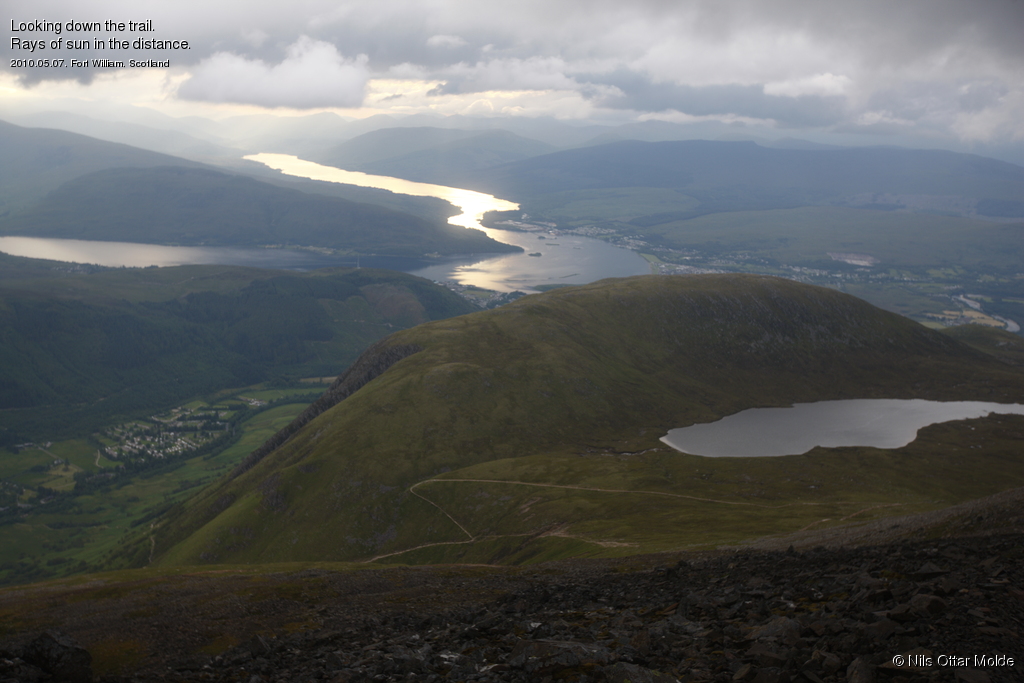
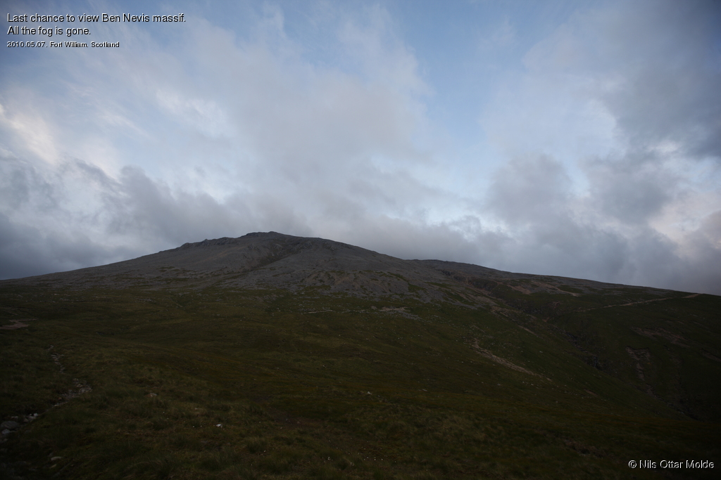
As we came out of the fog during the descent we noticed that this happened way higher than when we entered into the fog. Also in the distance we could see that the weater had clearly improved. There were even rays of sun in the distance.
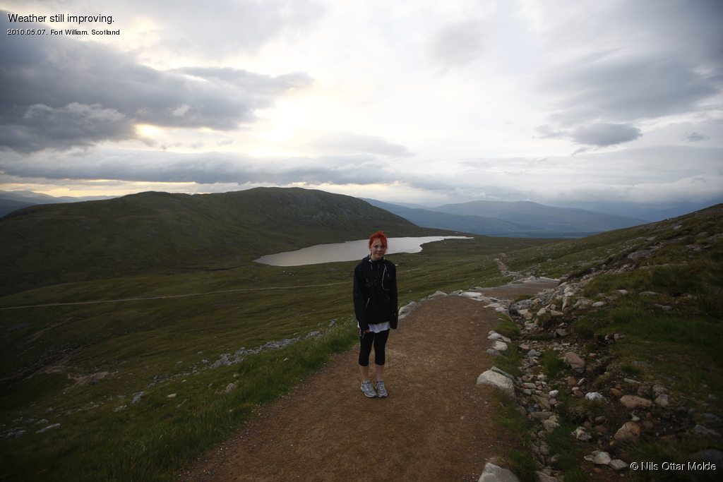
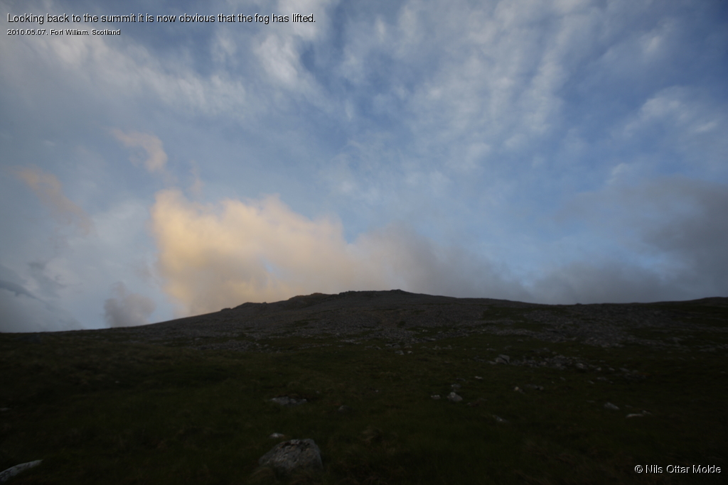
As we descended we looked back and in only a short time (probably about 30 minutes after leaving the summit) all the fog had lifted and we could enjoy a beautiful sky. It almost made us wish that we had started one hour later. The view from the summit would have been perfect now.
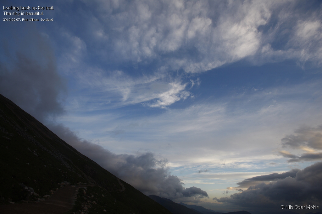
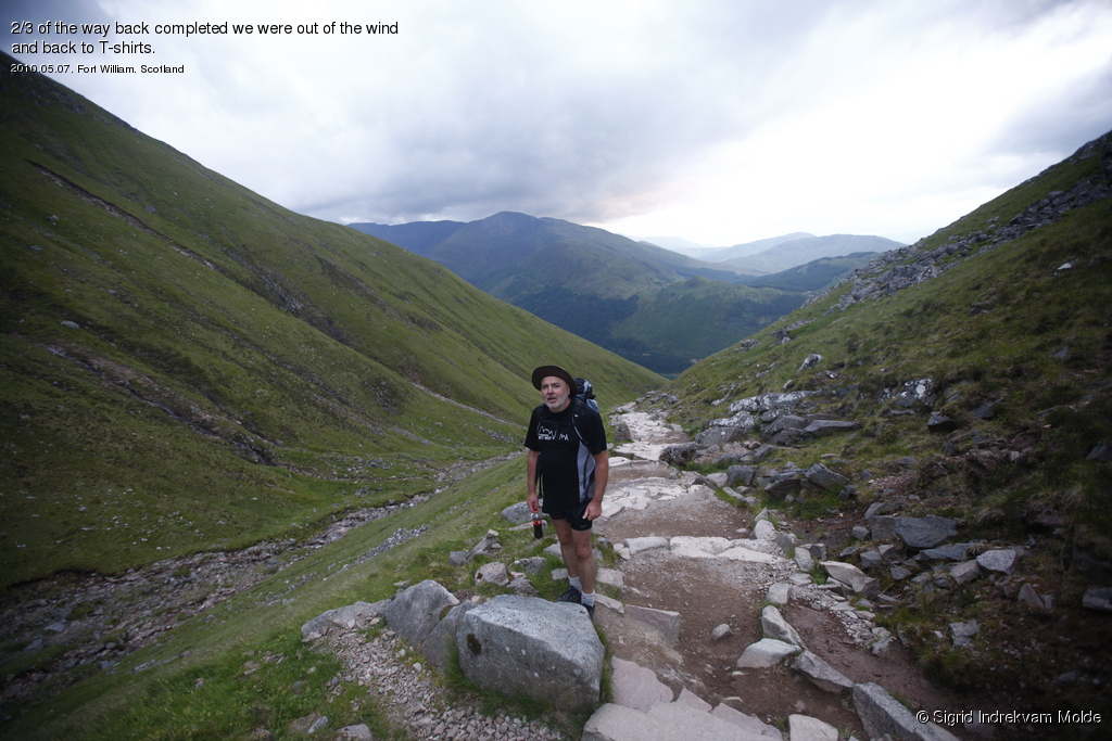
After we got out of the wind we stopped and removed the extra clothing. We held a nice pace down spending only 90 minutes from the summit to the trailhead and even overtaking two groups of hikers that we had met during our ascent.
Next stop was the hotel where Helen and Haakon were waiting. There a cold beer and a large glass of Cola waited for us.
We had heard a lot of the discomfort of walking in these mountains caused by the gnats. Our walk was so windy that we were not bothered by this at all. But back in the bar at the hotel, the glass doors out to the garden were open and the bar was litteraly filled with gnats. They became so annoying that we had to drain our glasses in a hurry and repair back to the hotel room where a good night of sleep awaited us.
Trivia/Reference
Photos are all taken with a Canon EOS-1 Ds Mark III camera, using a Canon EF 16-35mm II USM lens.
Here is how the GPS readings we collected during the trip is rendered in Google Earth.
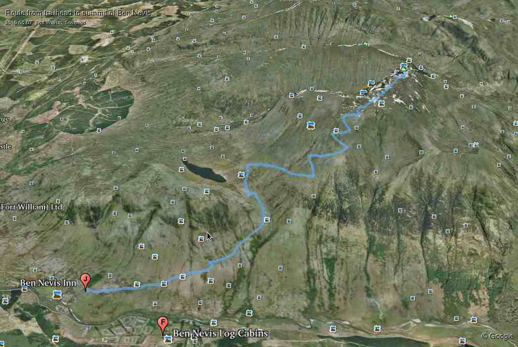
And below is the kml format of the route. Using the GPSBabel software, you could probably convert it to fit into your own GPS device.
This file can also be applied directly into Google Earth so you can view the route from many different angles and altitudes.
Download kml file for Ben Nevis
The pictures that forms the top border of the page are all of my daugther on the top of various mountains, including Mulhacen and Bobotov Kuk.